Looking for the best Newcastle walks? From spectacular coastal and beach walks to rainforest trails, harbour paths and peaceful bushland, Newcastle has an incredible variety of places to explore on foot.
Having lived in Newcastle for almost 20 years and photographed the region for more than a decade, I’ve explored many of these walks countless times. This guide brings together 15 of the best walks in Newcastle NSW, including the Newcastle Memorial Walk, Bathers Way Coastal Walk and Fernleigh Track, alongside quieter bushwalking and hiking trails through Glenrock, Blackbutt and beyond.
Whether you’re looking for an easy family walk, a scenic coastal stroll or a longer hike, you’ll find distances, difficulty, highlights, parking information and local tips to help you choose your next walk.
Quick Guide to the Best Newcastle Walks
| Walk | Distance | Difficulty |
|---|---|---|
| 1. Newcastle Memorial Walk | 450 m | Easy |
| 2. Fernleigh Track | 15 km | Easy |
| 3. Bathers Way Coastal Walk | 6 km | Easy–Moderate |
| 4. Yuelarbah Walking Track (Glenrock) | 6.8 km return | Moderate |
| 5. Nobbys Breakwall Walk | 3 km return | Easy |
| 6. Newcastle Coastal Geotrail | 10 km | Moderate |
| 7. Blackbutt Reserve Tall Trees Walk | 2.6 km | Easy |
| 8. Nobbys Headland Walk | 1.6 km return | Moderate |
| 9. Shipwreck Walk Stockton | 2 km return | Easy |
| 10. Hickson Street to Burwood Beach | 1 km return | Difficult |
| 11. King Edward Park to Newcastle Beach | 2 km return | Easy |
| 12. Honeysuckle Foreshore Walk | 2 km+ | Easy |
| 13. Throsby Creek Loop | 3.2 km | Easy |
| 14. Hunter Wetlands Rainforest Walk | 4 km return | Easy |
| 15. Blue Gum Hills Park Walk | 3 km loop | Moderate |
1. Newcastle Memorial Walk
One of Newcastle’s most iconic walks, combining spectacular clifftop views, ANZAC history and one of the city’s best vantage points for whale watching.
Location: Strzelecki Lookout to Memorial Drive | Distance: 450 m | Allow: 15–30 minutes | Difficulty: Easy | Highlights: Coastal views • ANZAC history • Whale watching • Sunrise & sunset
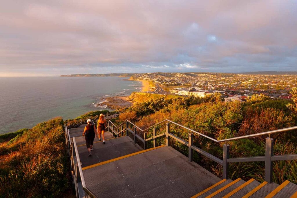

The Newcastle Memorial Walk, also known as the ANZAC Memorial Walk, is one of Newcastle’s most recognisable landmarks. Opened in 2015 to commemorate the ANZAC Centenary, the elevated clifftop walkway honours Hunter Region servicemen and women while offering panoramic views across the Pacific Ocean and Newcastle coastline.
Stretching 450 metres between Strzelecki Lookout and Memorial Drive, the walk provides sweeping views across Bar Beach and Merewether, south towards Glenrock State Conservation Area, and west towards the Newcastle city skyline. The section from Strzelecki Lookout to the main viewing platform is pram and wheelchair accessible, while 138 stairs continue down towards Memorial Drive and the coastal path. Steel silhouettes and interpretive displays honour local World War I servicemen and women, while the elevated clifftop position is also a popular spot for whale watching between May and November.
💡 Local Tip. Sunset is my favourite time to visit the Newcastle Memorial Walk. The elevated position provides beautiful afternoon light across Bar Beach and Merewether, and if you stay a little longer, the illuminated walkway and Newcastle city lights make the walk just as impressive after dark.
2. Fernleigh Track
A historic rail trail connecting Newcastle and Lake Macquarie through native bushland, wetlands and the impressive Fernleigh Track Tunnel.
Location: Adamstown to Belmont | Distance: 15.5 km one way | Allow: 3–5 hours walking | Difficulty: Easy | Highlights: Fernleigh Track Tunnel • Rail history • Bushland • Walking & cycling

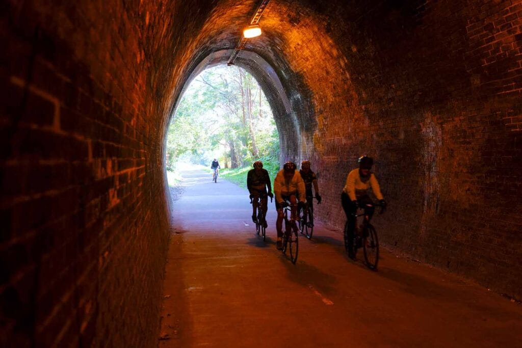

The Fernleigh Track follows the former Belmont railway line for 15.5 kilometres between Adamstown and Belmont, creating one of Newcastle and Lake Macquarie’s most popular walking and cycling trails. The fully sealed shared path follows a gentle railway gradient through native bushland, wetlands and coastal suburbs, with numerous access points allowing visitors to walk or cycle shorter sections rather than complete the entire track.
A highlight is the Fernleigh Track Tunnel, a beautifully preserved 181-metre brick-lined railway tunnel dating from the 1890s. The illuminated tunnel passes beneath the Pacific Highway and is one of the most distinctive reminders of the track’s railway history. Beyond the tunnel, the route continues through changing bushland and wetland landscapes towards Belmont, passing the former Kahibah Railway Station and connecting with the Great North Walk along the way.
💡 Local Tip. For a shorter walk, start near Kinross Avenue at Adamstown Heights and walk through the bushland to the Fernleigh Track Tunnel – the most impressive section without tackling the full trail.
3. Bathers Way Coastal Walk
Newcastle’s signature coastal walk, connecting spectacular beaches, ocean baths, clifftop lookouts and some of the city’s most iconic landmarks.
Location: Merewether to Nobbys Beach | Distance: 6 km one way | Allow: 2–3 hours | Difficulty: Easy–Moderate | Highlights: Beaches • Ocean baths • Memorial Walk • Coastal views • Whale watching


The Bathers Way Coastal Walk stretches for around 6 kilometres between Merewether Ocean Baths and Nobbys Beach, connecting many of Newcastle’s best-known beaches and coastal landmarks. The route passes Merewether Beach, Dixon Park Beach and Bar Beach before climbing towards the Newcastle Memorial Walk, with spectacular views across the Pacific Ocean and coastline along the way.
Continuing north, Bathers Way passes through King Edward Park and the historic Bogey Hole before reaching Newcastle Beach, Newcastle Ocean Baths and Nobbys Beach. With cafés, swimming spots, parks and lookouts located along the route, you can complete the entire walk or explore shorter sections. The elevated coastal sections are also excellent for whale watching between May and November, making Bathers Way one of the best ways to experience Newcastle’s coastline on foot.
💡 Local Tip. One of my favourite sections runs from Merewether Beach through Dixon Park and Bar Beach to the Newcastle Memorial Walk, combining some of the best coastal views with plenty of places to stop along the way. For photography or a quieter walk, early morning around sunrise is hard to beat.
4. Yuelarbah Walking Track (Glenrock)
One of Newcastle’s best bushwalks, winding through rainforest, creeks and native bushland before reaching spectacular views over Glenrock Lagoon and Burwood Beach.
Location: Glenrock State Conservation Area, Kahibah | Distance: 6.8 km return | Allow: 2–3 hours | Difficulty: Moderate | Highlights: Rainforest • Flaggy Creek • Leichhardt Lookout • Glenrock Lagoon • Burwood Beach
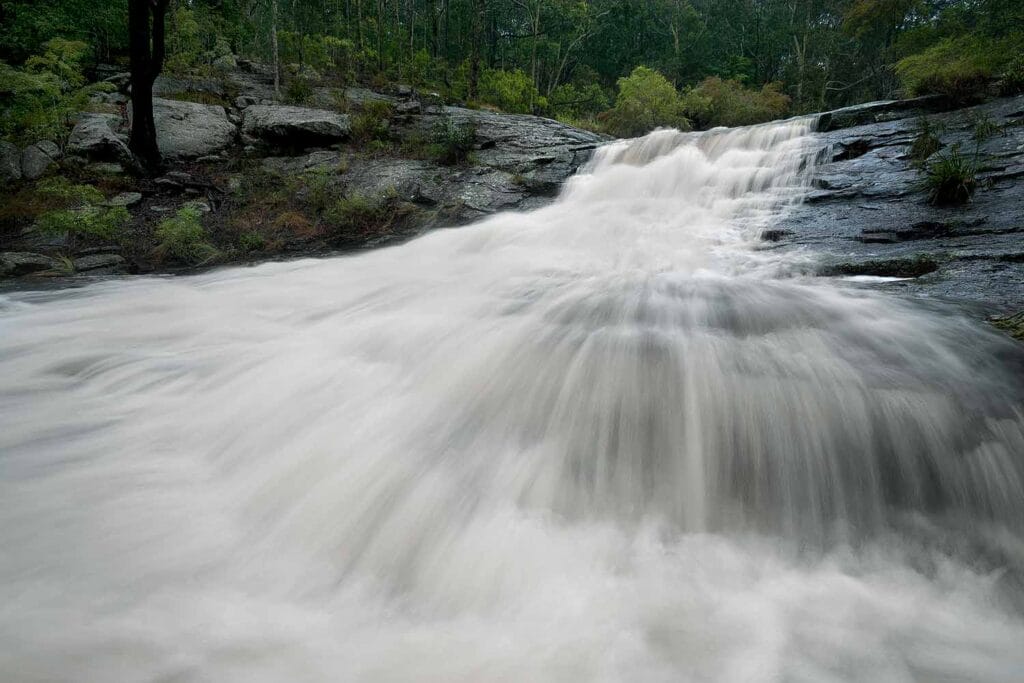
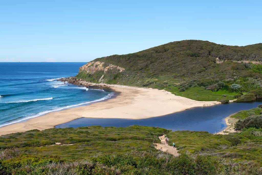


The Yuelarbah Walking Track in Glenrock State Conservation Area is one of the best bushwalks and hiking trails in Newcastle. Beginning at the Yuelarbah Trail car park on Burwood Road, the track forms part of the Great North Walk and winds through towering eucalypt forest, lush coastal rainforest and shaded gullies, with elevated boardwalks, creek crossings and seasonal waterfalls along the way.
A highlight is Leichhardt Lookout, with sweeping views across Glenrock Lagoon, Burwood Beach and the Pacific Ocean. From the lookout, the track continues downhill through bushland to Glenrock Lagoon and Burwood Beach before returning along the same route. The combination of rainforest, native wildlife, coastal scenery and beach access makes Yuelarbah one of Newcastle’s most varied walks despite being only a short distance from the city.
💡 Local Tip. Don’t turn around at Leichhardt Lookout. Continue down to Glenrock Lagoon and Burwood Beach to experience the full walk. I particularly like Yuelarbah after rainfall, when Flaggy Creek and the seasonal waterfalls are flowing and the rainforest is at its greenest.
5. Nobbys Breakwall Walk
An easy harbour walk where enormous ships, spectacular ocean views and marine wildlife make every visit a little different.
Location: Nobbys Beach & Newcastle Harbour | Distance: 3 km return | Allow: 45–60 minutes | Difficulty: Easy | Highlights: Harbour entrance • Ship spotting • Nobbys Lighthouse • Marine wildlife • Sunrise

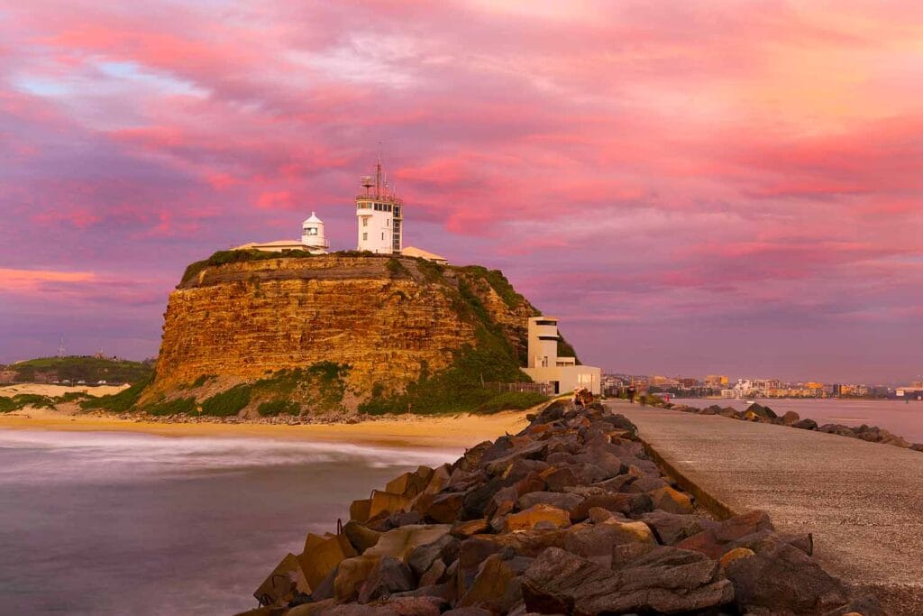

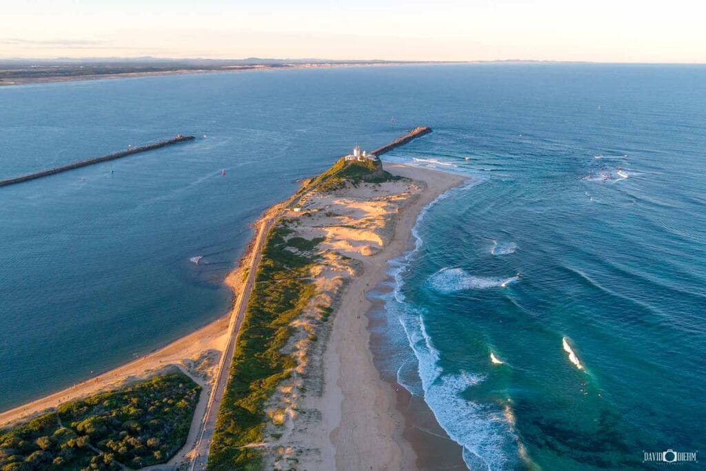
The Nobbys Breakwall Walk follows Macquarie Pier for approximately 1.5 kilometres from Nobbys Beach to the entrance of Newcastle Harbour. The flat, paved pathway offers views across Newcastle Harbour, Nobbys Lighthouse and the Pacific Ocean, while enormous coal ships, tugboats, cruise ships and recreational vessels regularly pass through one of Australia’s busiest working ports.
At the end of the breakwall, there are sweeping views towards Stockton Beach, across the Pacific Ocean and back towards Nobbys Lighthouse, Fort Scratchley and Newcastle’s coastline. Keep an eye out for dolphins and Australian fur seals around the harbour entrance, while migrating humpback whales can also be spotted offshore between May and November. Sunrise is particularly impressive, with changing light, passing ships and marine wildlife making this one of Newcastle’s most rewarding short coastal walks.
💡 Local Tip. Walk towards the end of the breakwall when a large ship is entering or leaving Newcastle Harbour — seeing these enormous vessels pass through the harbour entrance at close range is an incredible experience. Also check the rocks and harbour marker buoys for Australian fur seals.
6. Newcastle Coastal Geotrail
A fascinating coastal walk combining spectacular scenery with more than 300 million years of Newcastle’s geological and natural history.
Location: Nobbys Beach to Merewether | Distance: 10 km one way | Allow: 3–4 hours | Difficulty: Moderate | Highlights: Geology • Coastal cliffs • Rock platforms • Maritime history • 14 interpretive sites


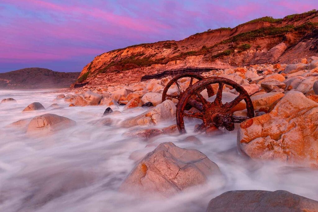
The Newcastle Coastal Geotrail follows the coastline from Nobbys Beach to Merewether, combining spectacular ocean scenery with more than 300 million years of geological history. Rather than following a single dedicated track, the self-guided trail connects 14 interpretive sites where exposed cliffs, rock platforms and headlands reveal how ancient environments and geological processes shaped the Newcastle coastline.
Along the route, the geotrail also explores the connection between Newcastle’s geology and its Aboriginal heritage, coal mining, maritime history and coastal development. Highlights include Nobbys Headland, Newcastle Beach, King Edward Park, the Bogey Hole, Susan Gilmore Beach and Merewether, with interpretive displays explaining features such as exposed coal seams, sedimentary rock formations and historic ballast rocks brought to Newcastle aboard sailing ships.
💡 Local Tip. Visit around low tide if you want to see more of the exposed rock platforms and geological features, but always keep clear of waves and changing tides. Before setting out, download the official Newcastle Coastal Geotrail brochure, which includes a map and information about all 14 geotrail sites.
7. Blackbutt Reserve Tall Trees Walk
An easy family-friendly bushwalk through towering eucalypt forest, with playgrounds, picnic areas and native wildlife nearby.
Location: Richley Reserve, New Lambton | Distance: 2.6 km circuit | Allow: 45–60 minutes | Difficulty: Easy | Highlights: Tall eucalypts • Boardwalks • Wildlife • Adventure playground • Picnic areas


The Blackbutt Reserve Tall Trees Walk is an easy 2.6-kilometre circuit through the peaceful bushland of Richley Reserve in New Lambton. The trail winds beneath towering eucalypts and through native forest, with boardwalks, ponds and shaded sections along the way. Its gentle terrain and relatively short distance make it one of the best family-friendly walks in Newcastle, particularly for families with younger children.
Richley Reserve also features the popular Mega Adventure Playground, picnic areas, barbecues and open lawns, making it easy to turn the walk into a longer family outing. Nearby Carnley Reserve is home to Blackbutt’s free wildlife exhibits, where visitors can see koalas, wombats, kangaroos, emus and other Australian animals. Combining the Tall Trees Walk with both areas is a great way to experience the bushland, wildlife and family attractions of Blackbutt Reserve.
💡 Local Tip. Allow some extra time before or after the walk for the Mega Adventure Playground and picnic areas at Richley Reserve. If you’re visiting with children, combine it with the free wildlife exhibits at Carnley Reserve for an easy half-day family outing.
8. Nobbys Headland Walk
A short climb to one of Newcastle’s most iconic landmarks, with panoramic views across the harbour, coastline and Pacific Ocean.
Location: Nobbys Beach & Nobbys Headland | Distance: 1.6 km return | Allow: 30–60 minutes | Difficulty: Moderate | Highlights: Nobbys Lighthouse • Harbour views • Ship spotting • Whale watching • Maritime history


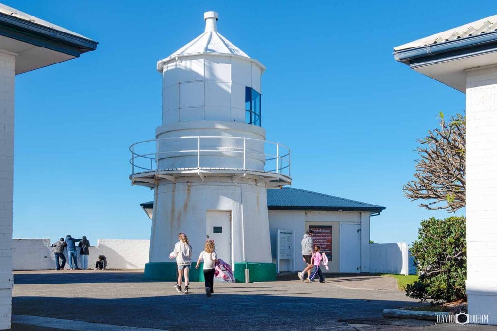
The Nobbys Headland Walk begins near Nobbys Beach and climbs to the historic Nobbys Lighthouse, one of Newcastle’s most recognisable landmarks. First illuminated in 1858, the lighthouse overlooks the entrance to Newcastle Harbour, with panoramic views across Nobbys Beach, Stockton, the city and the Pacific Ocean. The elevated position is also excellent for watching enormous coal ships, tugboats and cruise ships entering and leaving the harbour.
Although relatively short, the steady uphill climb makes this walk more challenging than the nearby Nobbys Breakwall. At the top, the Nobbys Lighthouse precinct provides some of the best views in Newcastle and is particularly worthwhile when the precinct is open to visitors. Between May and November, the headland is also an excellent vantage point for spotting migrating humpback whales travelling along the coastline.
💡 Local Tip. When you reach the top, turn around and look back towards Newcastle — the view across Nobbys Beach, the harbour and city is one of my favourite perspectives in Newcastle. If the lighthouse precinct is open, allow some extra time to explore Lighthouse Arts in the historic lighthouse cottages and enjoy the views from around the headland.
9. Shipwreck Walk Stockton
An easy harbour walk combining Newcastle’s fascinating maritime history with shipwreck remains and spectacular views across Newcastle Harbour.
Location: Stockton Breakwall | Distance: 2 km return | Allow: 30–45 minutes | Difficulty: Easy | Highlights: Adolphe shipwreck • Maritime history • Harbour views • Ship spotting • Nobbys Lighthouse
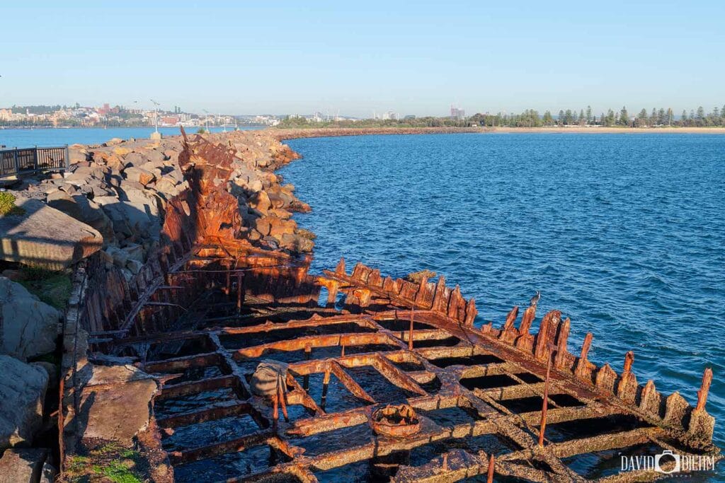


The Shipwreck Walk at Stockton Breakwall follows a flat pathway beside the Hunter River, combining excellent views across Newcastle Harbour with stories from the city’s maritime past. Interpretive displays along the route reveal how shifting sandbanks and the notorious Oyster Bank contributed to numerous shipwrecks around the harbour entrance, while Nobbys Lighthouse and Newcastle’s coastline provide a spectacular backdrop across the water.
The highlight is the wreck of the Adolphe, a French four-masted sailing ship wrecked on the Oyster Bank during a storm in 1904. Its rusting remains can still be seen beside the breakwall, with a viewing platform providing a closer look at one of Newcastle’s most significant maritime relics. Continue along the breakwall for views of enormous coal ships, tugboats and other vessels entering and leaving one of Australia’s busiest working ports.
💡 Local Tip. Sunrise is my favourite time to walk the Stockton Breakwall, when the morning light falls across Nobbys Lighthouse and the Newcastle coastline. After visiting the Adolphe, continue towards the end of the breakwall for some of the best views across the harbour entrance and passing ships.
10. Hickson Street to Burwood Beach
A steep but rewarding coastal walk descending from Hickson Street Lookout through Glenrock bushland to the secluded sands of Burwood Beach.
Location: Hickson Street Lookout, Merewether | Distance: 1 km return | Allow: 30–60 minutes | Difficulty: Difficult | Highlights: Burwood Beach • Coastal views • Glenrock bushland • Sunset • Paragliders
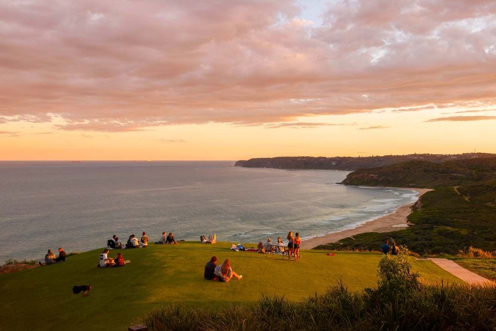


The Hickson Street to Burwood Beach Walk, also known as the Hickson Track, begins at Hickson Street Lookout in Merewether and descends through coastal heath and bushland within Glenrock State Conservation Area. Before heading down, take in the panoramic views across Burwood Beach, the Pacific Ocean and Newcastle’s southern coastline. The lookout is particularly impressive around sunset and is also a popular launch site for hang gliders and paragliders when conditions are suitable.
At the bottom, Burwood Beach offers a quieter and more secluded experience than Newcastle’s patrolled city beaches, surrounded by sandstone cliffs and Glenrock bushland. The descent is relatively short, but the steep stairs and climb back to Hickson Street Lookout make the return journey considerably more challenging. Allow some extra time to explore the beach and enjoy the coastal scenery before tackling the climb back up.
💡 Local Tip. Hickson Street Lookout is one of my favourite sunset locations in Newcastle, so time your return climb to reach the lookout before the sun goes down. On afternoons with favourable winds, you may also see hang gliders and paragliders launching from the clifftop and soaring above Burwood Beach.
11. King Edward Park to Newcastle Beach
A scenic coastal walk through Newcastle’s oldest public park, connecting historic landmarks, clifftop views and Newcastle Beach.
Location: King Edward Park to Newcastle Beach | Distance: 2 km return | Allow: 30–45 minutes | Difficulty: Easy | Highlights: King Edward Park • Bogey Hole • Coastal views • Newcastle Beach • Heritage

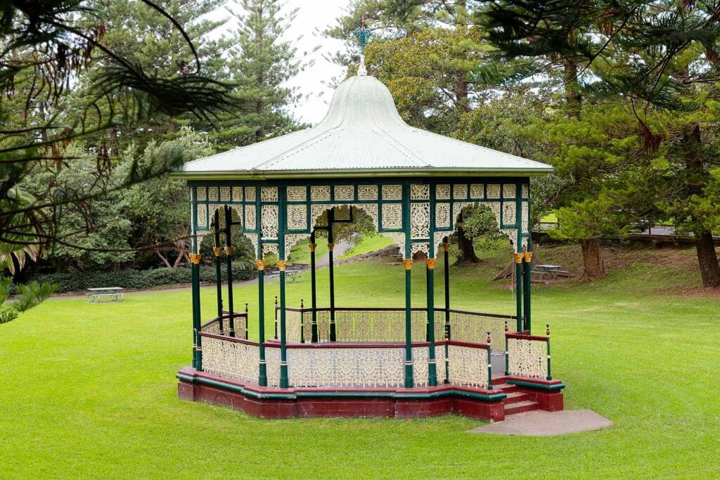

The King Edward Park to Newcastle Beach Walk combines beautiful parkland, coastal scenery and some of Newcastle’s most significant historic landmarks. Beginning in King Edward Park, established in 1863, the route passes landscaped gardens, towering Norfolk Island Pines and clifftop lookouts before continuing along the coastline towards Newcastle Beach. Along the way, a short detour leads to the Bogey Hole, the heritage-listed ocean pool hand-carved into the rock by convicts in 1819.
Continuing towards Newcastle Beach, the walk joins Bathers Way and passes the South Newcastle Skate Park, with spectacular views across the Pacific Ocean along the way. The elevated sections around King Edward Park are also excellent for whale watching between May and November. Once at Newcastle Beach, you can continue towards Newcastle Ocean Baths and Nobbys Beach or return through the park.
💡 Local Tip. Take a few extra minutes to explore the Sunken Garden and Bogey Hole rather than simply walking straight through King Edward Park. For photography, the elevated lookouts around the park are particularly beautiful around sunrise, with expansive views across the Pacific Ocean and Newcastle coastline.
12. Honeysuckle Foreshore Walk
An easy waterfront walk combining Newcastle Harbour views, waterfront dining and the constant activity of one of Australia’s busiest working ports.
Location: Honeysuckle & Newcastle Harbour | Distance: 2 km+ return | Allow: 30–60 minutes | Difficulty: Easy | Highlights: Harbour views • Ship spotting • Waterfront dining • Foreshore Park • Sunset

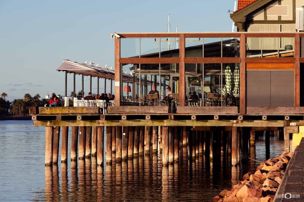


The Honeysuckle Foreshore Walk follows the southern edge of Newcastle Harbour through one of the city’s most popular waterfront precincts. The flat shared pathway passes cafés, restaurants, public spaces and former industrial areas, with excellent views across the harbour and its constantly changing maritime activity. Coal ships, tugboats, ferries, yachts and pilot vessels regularly pass along the channel, making this a very different experience from Newcastle’s coastal and bush walks.
The walk can be as short or long as you like, with easy connections towards Newcastle Museum, Queens Wharf and Foreshore Park, or further towards Nobbys Beach. Honeysuckle’s waterfront restaurants and cafés also make it an ideal walk to combine with breakfast, lunch or dinner, while the flat pathway and nearby light rail stops make it one of the easiest Newcastle walks to incorporate into a day exploring the city.
💡 Local Tip. Late afternoon into sunset is my favourite time to walk Honeysuckle. The harbour is often busy with ferries, tugboats and large ships, while the setting sun and city lights create beautiful reflections across the water. Finish with dinner or a drink at one of the waterfront venues overlooking Newcastle Harbour.
13. Throsby Creek Loop
An easy waterfront circuit through Carrington, Maryville and Islington, combining peaceful creek scenery, mangroves and Newcastle’s active outdoor lifestyle.
Location: Carrington, Maryville & Islington | Distance: 3.2 km circuit | Allow: 45–60 minutes | Difficulty: Easy | Highlights: Waterfront paths • Mangroves • Birdlife • Dragon boats • Sunrise

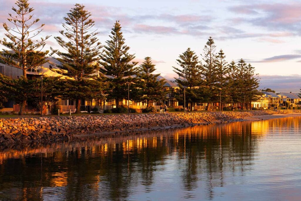

The Throsby Creek Loop follows a mostly flat shared pathway around the waterways connecting Carrington, Maryville and Islington. Popular with walkers, runners and cyclists, the circuit passes waterfront parklands, playgrounds and picnic areas while offering changing views across Throsby Creek. The calm water is regularly used by rowing crews, dragon boat teams, kayakers and paddleboarders, giving the area a relaxed but active atmosphere.
A highlight is the timber boardwalk through the mangroves near Islington, where the urban surroundings give way to an important estuarine environment filled with birdlife and other wildlife. With its easy terrain and combination of waterfront scenery, parkland and mangroves, the Throsby Creek Loop offers a very different experience from Newcastle’s better-known coastal walks.
💡 Local Tip. Early morning is my favourite time to walk Throsby Creek, when the water is often at its calmest and produces beautiful reflections. You’ll also have a good chance of seeing rowing crews, dragon boats and paddlers training on the creek before the shared pathway becomes busier later in the day.
14. Hunter Wetlands Rainforest Walk
A peaceful nature walk through wetlands, rainforest and wildlife habitat at one of Newcastle’s best birdwatching destinations.
Location: Hunter Wetlands Centre, Shortland | Distance: 4 km return | Allow: 1–1.5 hours | Difficulty: Easy | Highlights: Wetlands • Rainforest • Birdwatching • Wildlife • Boardwalks



The Hunter Wetlands Rainforest Walk explores the lakes, wetlands and pockets of subtropical rainforest surrounding the Hunter Wetlands Centre at Shortland. A network of mostly flat walking tracks and boardwalks passes through a variety of habitats, providing excellent opportunities to spot native birds, turtles, frogs and other wildlife. The centre forms part of the internationally significant Hunter Estuary Wetlands, making this one of Newcastle’s most important natural environments.
The wetlands are particularly renowned for birdwatching, with more than 200 bird species recorded across the reserve. Depending on the season, you may encounter Magpie Geese, Black Swans, Spoonbills, Egrets and Herons, while bird hides and observation points provide excellent places to stop and watch the wildlife. A small admission fee applies, helping support the conservation and ongoing management of the wetlands.
💡 Local Tip. Visit early in the morning when the wetlands are quiet and bird activity is often at its best. Bring binoculars or a camera with a longer lens and take your time around the bird hides and boardwalks – you never know what might appear among the reeds and waterways.
15. Blue Gum Hills Park Walk
A family-friendly bushwalk combining peaceful eucalypt forest, Newcastle’s coal-mining heritage and plenty of activities for children.
Location: Blue Gum Hills Regional Park, Minmi | Distance: 3 km circuit | Allow: 1.5–2 hours | Difficulty: Easy–Moderate | Highlights: Bushwalking • Mining heritage • Wildflowers • Wildlife • Nature playground

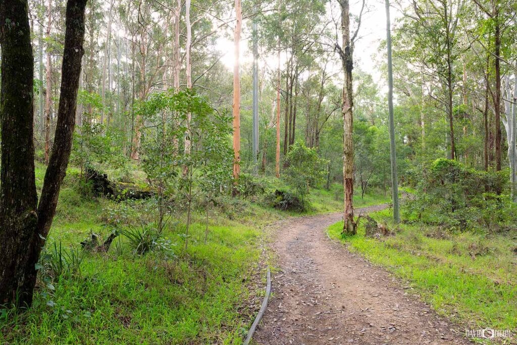
The Blue Gum Hills Regional Park Walk explores the peaceful eucalypt forest and fascinating mining history surrounding Minmi. The approximately 3-kilometre Heritage Walking Track follows sections of the former Minmi Back Creek railway embankment, passing remnants of the area’s coal-mining past, including old bridge abutments, mine workings and the distinctive brick ventilation shaft of Brown’s Colliery No. 2. Today, regenerated bushland, native birds and seasonal wildflowers create a very different landscape from the industrial site that once occupied the area.
Blue Gum Hills is particularly good for families, with a nature playground, timber maze, picnic shelters and barbecue facilities located near the main picnic area. Keep an eye out for goannas and native birds along the walking tracks, while spring is particularly beautiful when wildflowers appear throughout the bushland. The combination of an easy bushwalk, local history and family activities makes this a great alternative to Newcastle’s better-known coastal walks.
💡 Local Tip. If you’re visiting with children, allow plenty of extra time after the walk for the nature playground and timber maze — they can easily become the highlight of the visit. Spring is my favourite time to explore the park, when native wildflowers add plenty of colour to the surrounding bushland.
Location: Strzelecki Lookout to Memorial Drive | Distance: 450 m | Allow: 15–30 minutes | Difficulty: Easy | Highlights: Coastal views • ANZAC history • Whale watching • Sunrise & sunset
The Newcastle Memorial Walk, also known as the ANZAC Memorial Walk, is one of Newcastle’s most recognisable landmarks. Opened in 2015 to commemorate the ANZAC Centenary, the elevated clifftop walkway honours Hunter Region servicemen and women while offering panoramic views across the Pacific Ocean and Newcastle coastline.
Stretching 450 metres between Strzelecki Lookout and Memorial Drive, the walk provides sweeping views across Bar Beach and Merewether, south towards Glenrock State Conservation Area, and west towards the Newcastle city skyline. The section from Strzelecki Lookout to the main viewing platform is pram and wheelchair accessible, while 138 stairs continue down towards Memorial Drive and the coastal path. Steel silhouettes and interpretive displays honour local World War I servicemen and women, while the elevated clifftop position is also a popular spot for whale watching between May and November.
💡 Local Tip. Sunset is my favourite time to visit, with beautiful light across Bar Beach and Merewether. Stay a little longer to see the walkway illuminated after dark.
Location: Adamstown to Belmont | Distance: 15.5 km one way | Allow: 3–5 hours walking | Difficulty: Easy | Highlights: Fernleigh Track Tunnel • Rail history • Bushland • Walking & cycling
The Fernleigh Track follows the former Belmont railway line for 15.5 kilometres between Adamstown and Belmont, creating one of Newcastle and Lake Macquarie’s most popular walking and cycling trails. The fully sealed shared path follows a gentle railway gradient through native bushland, wetlands and coastal suburbs, with numerous access points allowing visitors to walk or cycle shorter sections rather than complete the entire track.
A highlight is the Fernleigh Track Tunnel, a beautifully preserved 181-metre brick-lined railway tunnel dating from the 1890s. The illuminated tunnel passes beneath the Pacific Highway and is one of the most distinctive reminders of the track’s railway history. Beyond the tunnel, the route continues through changing bushland and wetland landscapes towards Belmont, passing the former Kahibah Railway Station and connecting with the Great North Walk along the way.
💡 Local Tip. For a shorter walk, start near Kinross Avenue at Adamstown Heights and walk through the bushland to the Fernleigh Track Tunnel – the most impressive section without tackling the full trail.
Location: Merewether to Nobbys Beach | Distance: 6 km one way | Allow: 2–3 hours | Difficulty: Easy–Moderate | Highlights: Beaches • Ocean baths • Memorial Walk • Coastal views • Whale watching
The Bathers Way Coastal Walk stretches for around 6 kilometres between Merewether Ocean Baths and Nobbys Beach, connecting many of Newcastle’s best-known beaches and coastal landmarks. The route passes Merewether Beach, Dixon Park Beach and Bar Beach before climbing towards the Newcastle Memorial Walk, with spectacular views across the Pacific Ocean and coastline along the way.
Continuing north, Bathers Way passes through King Edward Park and the historic Bogey Hole before reaching Newcastle Beach, Newcastle Ocean Baths and Nobbys Beach. With cafés, swimming spots, parks and lookouts located along the route, you can complete the entire walk or explore shorter sections. The elevated coastal sections are also excellent for whale watching between May and November, making Bathers Way one of the best ways to experience Newcastle’s coastline on foot.
💡 Local Tip. Merewether Beach to the Memorial Walk is a favourite section. Visit at sunrise for beautiful light and fewer crowds.
Location: Glenrock State Conservation Area, Kahibah | Distance: 6.8 km return | Allow: 2–3 hours | Difficulty: Moderate | Highlights: Rainforest • Flaggy Creek • Leichhardt Lookout • Glenrock Lagoon • Burwood Beach
The Yuelarbah Walking Track in Glenrock State Conservation Area is one of the best bushwalks and hiking trails in Newcastle. Beginning at the Yuelarbah Trail car park on Burwood Road, the track forms part of the Great North Walk and winds through towering eucalypt forest, lush coastal rainforest and shaded gullies, with elevated boardwalks, creek crossings and seasonal waterfalls along the way.
A highlight is Leichhardt Lookout, with sweeping views across Glenrock Lagoon, Burwood Beach and the Pacific Ocean. From the lookout, the track continues downhill through bushland to Glenrock Lagoon and Burwood Beach before returning along the same route. The combination of rainforest, native wildlife, coastal scenery and beach access makes Yuelarbah one of Newcastle’s most varied walks despite being only a short distance from the city.
💡 Local Tip. Continue past Leichhardt Lookout to Glenrock Lagoon and Burwood Beach. After rain, Flaggy Creek and the waterfalls are especially beautiful.
Location: Nobbys Beach & Newcastle Harbour | Distance: 3 km return | Allow: 45–60 minutes | Difficulty: Easy | Highlights: Harbour entrance • Ship spotting • Nobbys Lighthouse • Marine wildlife • Sunrise
The Nobbys Breakwall Walk follows Macquarie Pier for approximately 1.5 kilometres from Nobbys Beach to the entrance of Newcastle Harbour. The flat, paved pathway offers views across Newcastle Harbour, Nobbys Lighthouse and the Pacific Ocean, while enormous coal ships, tugboats, cruise ships and recreational vessels regularly pass through one of Australia’s busiest working ports.
At the end of the breakwall, there are sweeping views towards Stockton Beach, across the Pacific Ocean and back towards Nobbys Lighthouse, Fort Scratchley and Newcastle’s coastline. Keep an eye out for dolphins and Australian fur seals around the harbour entrance, while migrating humpback whales can also be spotted offshore between May and November. Sunrise is particularly impressive, with changing light, passing ships and marine wildlife making this one of Newcastle’s most rewarding short coastal walks.
💡 Local Tip. Head to the end of the breakwall as a large ship passes through the harbour entrance. Keep an eye out for Australian fur seals on the rocks and marker buoys.
Location: Nobbys Beach to Merewether | Distance: 10 km one way | Allow: 3–4 hours | Difficulty: Moderate | Highlights: Geology • Coastal cliffs • Rock platforms • Maritime history • 14 interpretive sites
The Newcastle Coastal Geotrail follows the coastline from Nobbys Beach to Merewether, combining spectacular ocean scenery with more than 300 million years of geological history. Rather than following a single dedicated track, the self-guided trail connects 14 interpretive sites where exposed cliffs, rock platforms and headlands reveal how ancient environments and geological processes shaped the Newcastle coastline.
Along the route, the geotrail also explores the connection between Newcastle’s geology and its Aboriginal heritage, coal mining, maritime history and coastal development. Highlights include Nobbys Headland, Newcastle Beach, King Edward Park, the Bogey Hole, Susan Gilmore Beach and Merewether, with interpretive displays explaining features such as exposed coal seams, sedimentary rock formations and historic ballast rocks brought to Newcastle aboard sailing ships.
💡 Local Tip. Download the official Newcastle Coastal Geotrail brochure, for a map of all 14 sites.
Location: Richley Reserve, New Lambton | Distance: 2.6 km circuit | Allow: 45–60 minutes | Difficulty: Easy | Highlights: Tall eucalypts • Boardwalks • Wildlife • Adventure playground • Picnic areas
The Blackbutt Reserve Tall Trees Walk is an easy 2.6-kilometre circuit through the peaceful bushland of Richley Reserve in New Lambton. The trail winds beneath towering eucalypts and through native forest, with boardwalks, ponds and shaded sections along the way. Its gentle terrain and relatively short distance make it one of the best family-friendly walks in Newcastle, particularly for families with younger children.
Richley Reserve also features the popular Mega Adventure Playground, picnic areas, barbecues and open lawns, making it easy to turn the walk into a longer family outing. Nearby Carnley Reserve is home to Blackbutt’s free wildlife exhibits, where visitors can see koalas, wombats, kangaroos, emus and other Australian animals. Combining the Tall Trees Walk with both areas is a great way to experience the bushland, wildlife and family attractions of Blackbutt Reserve.
💡 Local Tip. Allow extra time for the Mega Adventure Playground, or combine the walk with the free wildlife exhibits at Carnley Reserve.
Location: Nobbys Beach & Nobbys Headland | Distance: 1.6 km return | Allow: 30–60 minutes | Difficulty: Moderate | Highlights: Nobbys Lighthouse • Harbour views • Ship spotting • Whale watching • Maritime history
The Nobbys Headland Walk begins near Nobbys Beach and climbs to the historic Nobbys Lighthouse, one of Newcastle’s most recognisable landmarks. First illuminated in 1858, the lighthouse overlooks the entrance to Newcastle Harbour, with panoramic views across Nobbys Beach, Stockton, the city and the Pacific Ocean. The elevated position is also excellent for watching enormous coal ships, tugboats and cruise ships entering and leaving the harbour.
Although relatively short, the steady uphill climb makes this walk more challenging than the nearby Nobbys Breakwall. At the top, the Nobbys Lighthouse precinct provides some of the best views in Newcastle and is particularly worthwhile when the precinct is open to visitors. Between May and November, the headland is also an excellent vantage point for spotting migrating humpback whales travelling along the coastline.
💡 Local Tip. At the top, look back towards Newcastle for one of my favourite views across Nobbys Beach, the harbour and city. If open, explore Lighthouse Arts in the historic cottages.
Location: Stockton Breakwall | Distance: 2 km return | Allow: 30–45 minutes | Difficulty: Easy | Highlights: Adolphe shipwreck • Maritime history • Harbour views • Ship spotting • Nobbys Lighthouse
The Shipwreck Walk at Stockton Breakwall follows a flat pathway beside the Hunter River, combining excellent views across Newcastle Harbour with stories from the city’s maritime past. Interpretive displays along the route reveal how shifting sandbanks and the notorious Oyster Bank contributed to numerous shipwrecks around the harbour entrance, while Nobbys Lighthouse and Newcastle’s coastline provide a spectacular backdrop across the water.
The highlight is the wreck of the Adolphe, a French four-masted sailing ship wrecked on the Oyster Bank during a storm in 1904. Its rusting remains can still be seen beside the breakwall, with a viewing platform providing a closer look at one of Newcastle’s most significant maritime relics. Continue along the breakwall for views of enormous coal ships, tugboats and other vessels entering and leaving one of Australia’s busiest working ports.
💡 Local Tip. Sunrise is my favourite time to walk Stockton Breakwall. Continue past the Adolphe for great views of the harbour entrance and passing ships.
Location: Hickson Street Lookout, Merewether | Distance: 1 km return | Allow: 30–60 minutes | Difficulty: Difficult | Highlights: Burwood Beach • Coastal views • Glenrock bushland • Sunset • Paragliders
The Hickson Street to Burwood Beach Walk, also known as the Hickson Track, begins at Hickson Street Lookout in Merewether and descends through coastal heath and bushland within Glenrock State Conservation Area. Before heading down, take in the panoramic views across Burwood Beach, the Pacific Ocean and Newcastle’s southern coastline. The lookout is particularly impressive around sunset and is also a popular launch site for hang gliders and paragliders when conditions are suitable.
At the bottom, Burwood Beach offers a quieter and more secluded experience than Newcastle’s patrolled city beaches, surrounded by sandstone cliffs and Glenrock bushland. The descent is relatively short, but the steep stairs and climb back to Hickson Street Lookout make the return journey considerably more challenging. Allow some extra time to explore the beach and enjoy the coastal scenery before tackling the climb back up.
💡 Local Tip. Time your return for sunset at Hickson Street Lookout. On windy afternoons, you may also see hang gliders and paragliders soaring above Burwood Beach.
Location: King Edward Park to Newcastle Beach | Distance: 2 km return | Allow: 30–45 minutes | Difficulty: Easy | Highlights: King Edward Park • Bogey Hole • Coastal views • Newcastle Beach • Heritage
The King Edward Park to Newcastle Beach Walk combines beautiful parkland, coastal scenery and some of Newcastle’s most significant historic landmarks. Beginning in King Edward Park, established in 1863, the route passes landscaped gardens, towering Norfolk Island Pines and clifftop lookouts before continuing along the coastline towards Newcastle Beach. Along the way, a short detour leads to the Bogey Hole, the heritage-listed ocean pool hand-carved into the rock by convicts in 1819.
Continuing towards Newcastle Beach, the walk joins Bathers Way and passes the South Newcastle Skate Park, with spectacular views across the Pacific Ocean along the way. The elevated sections around King Edward Park are also excellent for whale watching between May and November. Once at Newcastle Beach, you can continue towards Newcastle Ocean Baths and Nobbys Beach or return through the park.
💡 Local Tip. Allow extra time to explore the Sunken Garden and Bogey Hole.
Location: Honeysuckle & Newcastle Harbour | Distance: 2 km+ return | Allow: 30–60 minutes | Difficulty: Easy | Highlights: Harbour views • Ship spotting • Waterfront dining • Foreshore Park • Sunset
The Honeysuckle Foreshore Walk follows the southern edge of Newcastle Harbour through one of the city’s most popular waterfront precincts. The flat shared pathway passes cafés, restaurants, public spaces and former industrial areas, with excellent views across the harbour and its constantly changing maritime activity. Coal ships, tugboats, ferries, yachts and pilot vessels regularly pass along the channel, making this a very different experience from Newcastle’s coastal and bush walks.
The walk can be as short or long as you like, with easy connections towards Newcastle Museum, Queens Wharf and Foreshore Park, or further towards Nobbys Beach. Honeysuckle’s waterfront restaurants and cafés also make it an ideal walk to combine with breakfast, lunch or dinner, while the flat pathway and nearby light rail stops make it one of the easiest Newcastle walks to incorporate into a day exploring the city.
💡 Local Tip. Visit Honeysuckle around sunset for beautiful harbour reflections and plenty of passing ships. Finish with dinner or a drink by the water.
Location: Carrington, Maryville & Islington | Distance: 3.2 km circuit | Allow: 45–60 minutes | Difficulty: Easy | Highlights: Waterfront paths • Mangroves • Birdlife • Dragon boats • Sunrise
The Throsby Creek Loop follows a mostly flat shared pathway around the waterways connecting Carrington, Maryville and Islington. Popular with walkers, runners and cyclists, the circuit passes waterfront parklands, playgrounds and picnic areas while offering changing views across Throsby Creek. The calm water is regularly used by rowing crews, dragon boat teams, kayakers and paddleboarders, giving the area a relaxed but active atmosphere.
A highlight is the timber boardwalk through the mangroves near Islington, where the urban surroundings give way to an important estuarine environment filled with birdlife and other wildlife. With its easy terrain and combination of waterfront scenery, parkland and mangroves, the Throsby Creek Loop offers a very different experience from Newcastle’s better-known coastal walks.
💡 Local Tip. Visit early morning for calm water, beautiful reflections and the chance to see rowing crews and paddlers training.
Location: Hunter Wetlands Centre, Shortland | Distance: 4 km return | Allow: 1–1.5 hours | Difficulty: Easy | Highlights: Wetlands • Rainforest • Birdwatching • Wildlife • Boardwalks
The Hunter Wetlands Rainforest Walk explores the lakes, wetlands and pockets of subtropical rainforest surrounding the Hunter Wetlands Centre at Shortland. A network of mostly flat walking tracks and boardwalks passes through a variety of habitats, providing excellent opportunities to spot native birds, turtles, frogs and other wildlife. The centre forms part of the internationally significant Hunter Estuary Wetlands, making this one of Newcastle’s most important natural environments.
The wetlands are particularly renowned for birdwatching, with more than 200 bird species recorded across the reserve. Depending on the season, you may encounter Magpie Geese, Black Swans, Spoonbills, Egrets and Herons, while bird hides and observation points provide excellent places to stop and watch the wildlife. A small admission fee applies, helping support the conservation and ongoing management of the wetlands.
💡 Local Tip. Visit early in the morning when bird activity is at its best. Bring binoculars or a camera and explore the bird hides and boardwalks.
Location: Blue Gum Hills Regional Park, Minmi | Distance: 3 km circuit | Allow: 1.5–2 hours | Difficulty: Easy–Moderate | Highlights: Bushwalking • Mining heritage • Wildflowers • Wildlife • Nature playground
The Blue Gum Hills Regional Park Walk explores the peaceful eucalypt forest and fascinating mining history surrounding Minmi. The approximately 3-kilometre Heritage Walking Track follows sections of the former Minmi Back Creek railway embankment, passing remnants of the area’s coal-mining past, including old bridge abutments, mine workings and the distinctive brick ventilation shaft of Brown’s Colliery No. 2. Today, regenerated bushland, native birds and seasonal wildflowers create a very different landscape from the industrial site that once occupied the area.
Blue Gum Hills is particularly good for families, with a nature playground, timber maze, picnic shelters and barbecue facilities located near the main picnic area. Keep an eye out for goannas and native birds along the walking tracks, while spring is particularly beautiful when wildflowers appear throughout the bushland. The combination of an easy bushwalk, local history and family activities makes this a great alternative to Newcastle’s better-known coastal walks.
💡 Local Tip. If visiting with children, allow extra time for the nature playground and timber maze. Spring is especially beautiful, when native wildflowers brighten the surrounding bushland.
Exploring the Best Walks in Newcastle
From spectacular coastal paths and harbour walks to rainforest trails, wetlands and peaceful bushland, Newcastle walks offer an incredible variety of landscapes to explore. Whether you’re looking for an easy waterfront stroll, a family-friendly adventure or a longer hike, there’s always somewhere new to discover.
So choose a walk, pull on your shoes and get out there. From the coastline to the bush, some of the best ways to experience Newcastle are on foot.
Explore More of Newcastle and the Hunter Region
Planning to explore more of Newcastle and the Hunter Region? These local guides will help you discover more of the area’s best beaches, attractions, lookouts and photography locations.
Newcastle
Lake Macquarie
Things to Do in Lake Macquarie
Best Beaches in Lake Macquarie
Port Stephens
Frequently Asked Questions About the Best Walks in Newcastle
What are the best walks in Newcastle NSW?
Some of the best walks in Newcastle include the Bathers Way Coastal Walk, Fernleigh Track, Yuelarbah Walking Track, Nobbys Breakwall Walk, Newcastle Memorial Walk, Stockton Beach Walk and Blackbutt Reserve. Together, these trails showcase Newcastle’s beaches, bushland, harbour, wetlands and coastal scenery.
What is the best walk in Newcastle?
The Bathers Way Coastal Walk is widely regarded as the best walk in Newcastle. Stretching 6 kilometres from Merewether Ocean Baths to Nobbys Beach, it passes some of the city’s most iconic attractions including the Newcastle Memorial Walk, King Edward Park, Newcastle Ocean Baths and several beautiful beaches.
What is the best coastal walk in Newcastle?
The Bathers Way Coastal Walk is Newcastle’s premier coastal walk. The trail follows the coastline from Merewether to Nobbys Beach and offers spectacular ocean views, beaches, ocean baths, whale watching opportunities and historic landmarks along the way.
What is the best bushwalk in Newcastle?
The Yuelarbah Walking Track in Glenrock State Conservation Area is considered one of Newcastle’s best bushwalks. The trail winds through rainforest, waterfalls, native bushland and scenic lookouts before reaching Glenrock Lagoon and Beach.
What is the best family-friendly walk in Newcastle?
Blackbutt Reserve’s Tall Trees Walk is one of the best family-friendly walks in Newcastle. The easy 2.6-kilometre circuit is suitable for children and can be combined with wildlife exhibits, playgrounds, picnic areas and barbecue facilities.
Can you walk from Merewether to Nobbys Beach?
Yes. The Bathers Way Coastal Walk provides a continuous 6-kilometre walking route between Merewether Ocean Baths and Nobbys Beach. Along the way you’ll pass Merewether Beach, Bar Beach, the Newcastle Memorial Walk, King Edward Park and Newcastle Ocean Baths.
Where can I go whale watching in Newcastle?
Some of the best whale-watching locations in Newcastle include the Newcastle Memorial Walk, Nobbys Headland, Bathers Way Coastal Walk, Hickson Street Lookout and Nobbys Breakwall. Humpback whales migrate along the Newcastle coastline between May and November each year.
What is the longest walking track in Newcastle?
The Fernleigh Track is one of the longest and most popular walking trails in Newcastle. Extending approximately 15 kilometres from Adamstown to Belmont, the former railway corridor passes through bushland, wetlands, coastal forest and the historic Fernleigh Tunnel.
What are the best sunrise walks in Newcastle?
The Nobbys Breakwall Walk, Stockton Beach Walk, Bathers Way Coastal Walk and Nobbys Headland Walk are among the best sunrise walks in Newcastle. These locations offer spectacular views as the sun rises over the Pacific Ocean and are particularly popular with photographers.
Are dogs allowed on Newcastle walking tracks?
Many Newcastle walking tracks allow dogs, including sections of Stockton Beach, Throsby Creek Loop and the Honeysuckle Foreshore. However, dogs are generally prohibited in Blackbutt Reserve and some conservation areas. Always check local signage and current regulations before visiting.