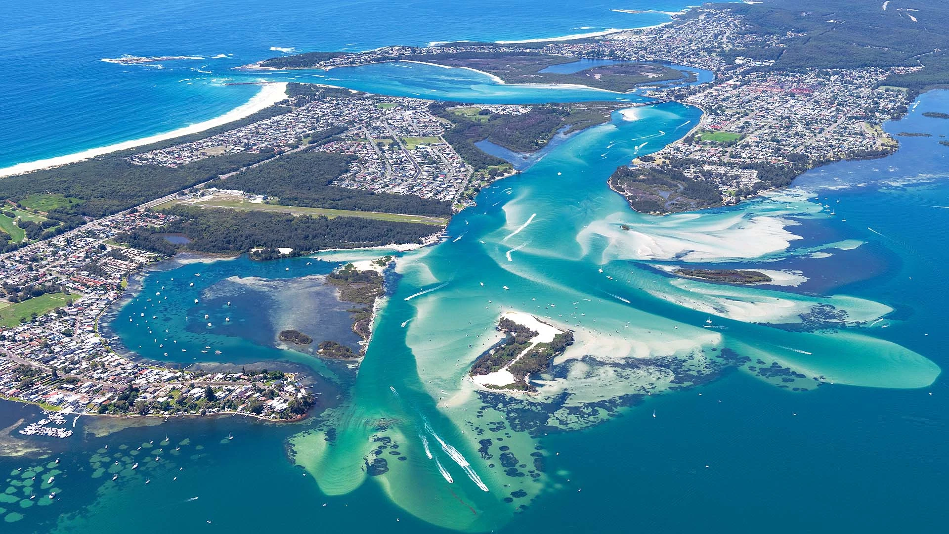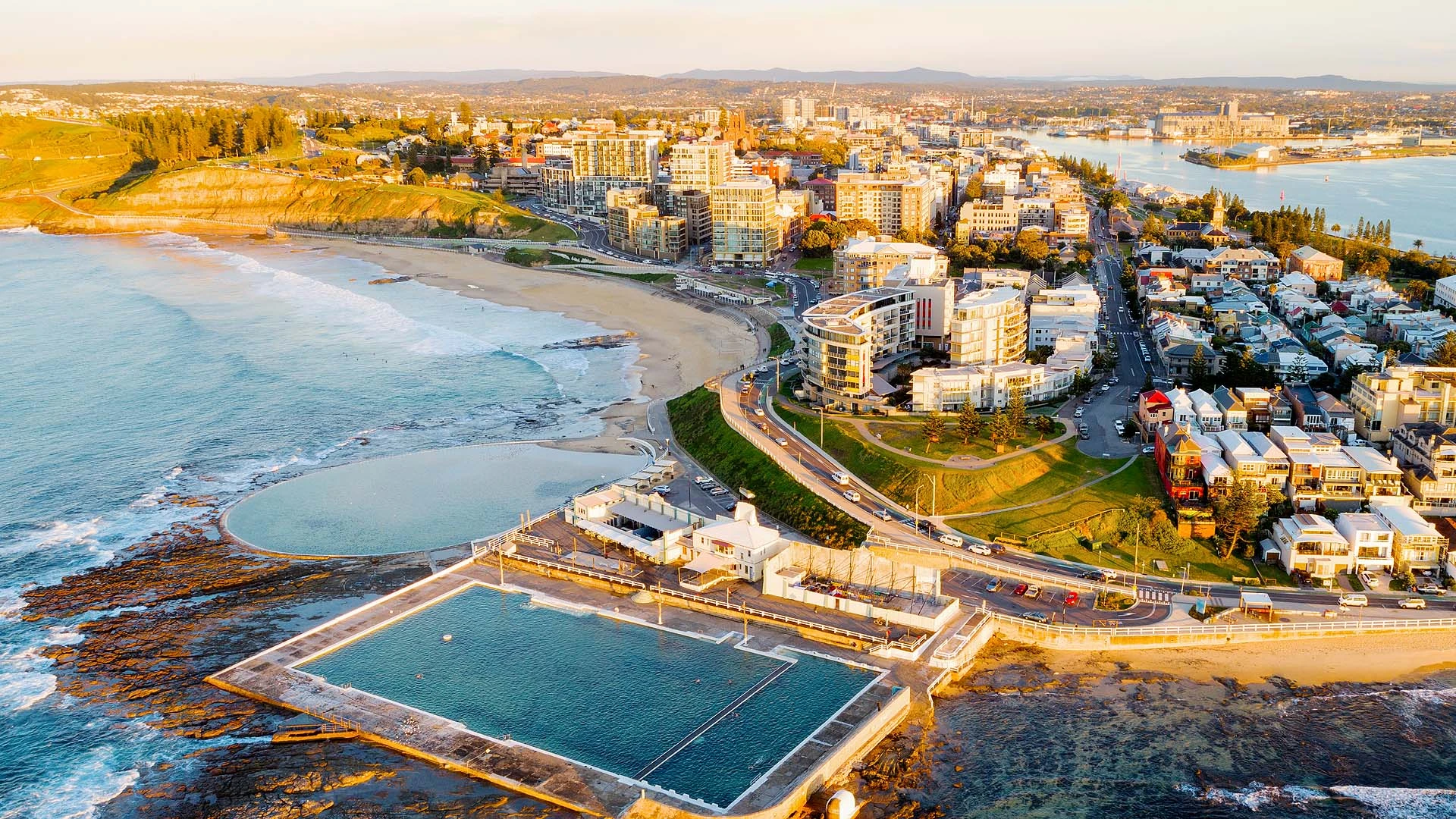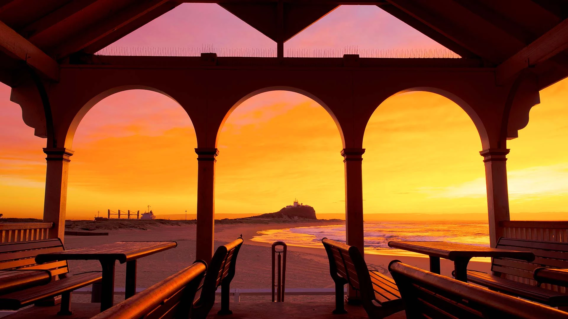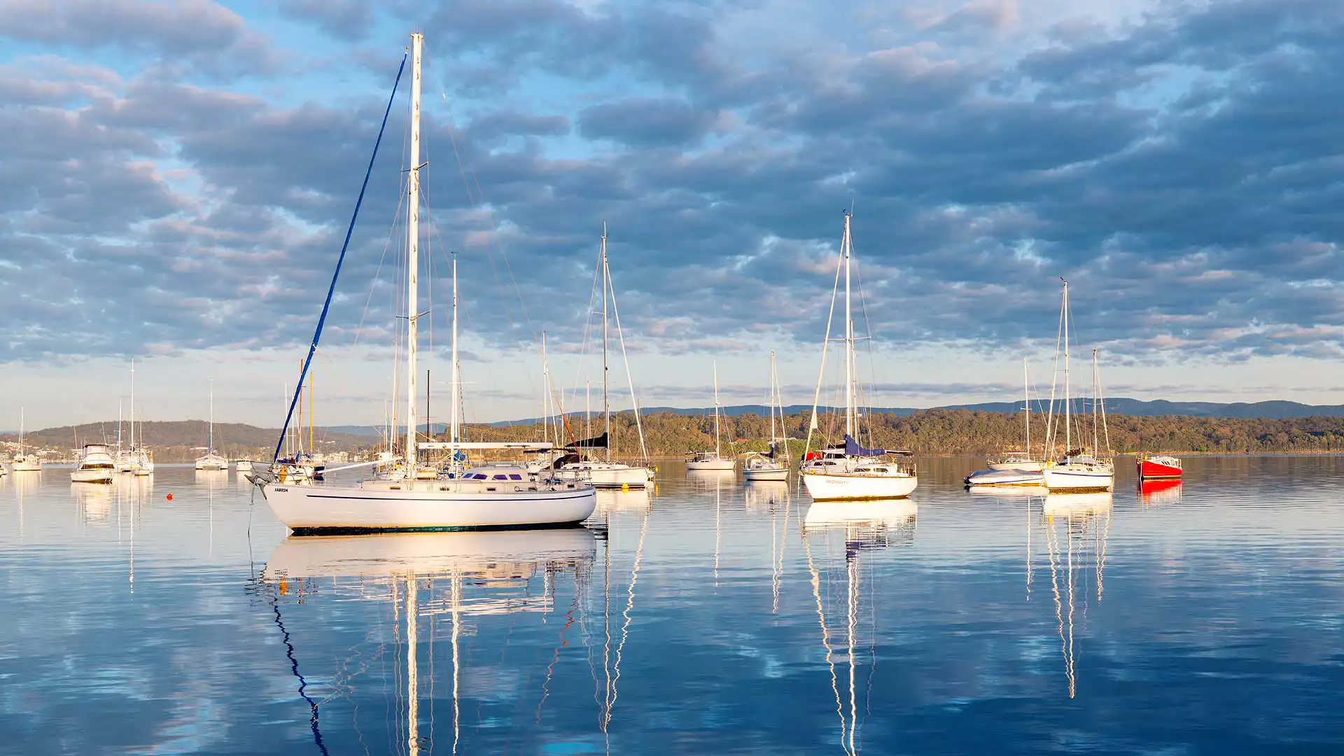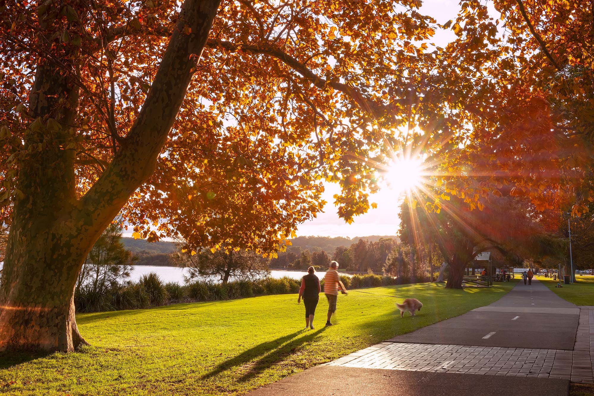
With a spectacular mix of coastal trails, lakeside paths and peaceful bushland, Lake Macquarie is home to some of the best walks in the Newcastle and Hunter region. From the popular Fernleigh Track and Yuelarbah Walking Track to shorter coastal walks, waterfalls and hidden bush trails, there’s something for almost every ability.
Having lived in the region for more than 20 years and spent over a decade exploring and photographing the Lake Macquarie landscape, I’ve walked many of these tracks myself. This guide brings together 15 of the best walks in Lake Macquarie, including easy family-friendly strolls, scenic walking tracks, coastal adventures and more challenging bush walks.
Lake Macquarie Walk Comparison Table
| Walk | Distance | Best For |
|---|---|---|
| Fernleigh Track | 15 km one-way | Walking & cycling |
| Yuelarbah Walking Track | 6.8 km return | Bushwalking |
| Caves Beach to Pinny Beach Walk | 5 km return | Coastal views |
| Catherine Hill Bay Rock Pools Walk | 3 km return | Rock pools & bushwalking |
| Warners Bay to Speers Point Walk | 5.6 km one-way | Lakeside scenery |
| Green Point Foreshore Walk | 7.7 km circuit | Lake views & sunsets |
| Mount Sugarloaf Walking Track | 1 km return | Views & families |
| Nine Mile Beach Walk | 10 km one-way | Beach walking |
| Red Bluff Boardwalk | 380m one-way | Boardwalk & lake views |
| Awabakal Coastal Walk (Wildflower Walk) | 1.5 km return | Wildflowers & coastal views |
| Ghosties Beach Walk | 4 km return | Secluded beach & sea cave |
| Boarding House Dam Walk | 700 m circuit | Rainforest & nature |
| Pirrita Island Walk (formerly Coon Island) | 2.5 km return | Lake & channel views |
| Gap Creek Falls Walk | 2 km return | Waterfall |
| Cooranbong Swing Bridge Walk | 3 km return | Families & wildlife |
1. Fernleigh Track
Follow a historic railway line through native bushland, wetlands and the iconic Fernleigh Track Tunnel.
Distance: 15 km one-way | Difficulty: Easy | Allow: 3–5 hours
Best For: Walking, cycling, families, history and wildlife | Parking: Adamstown, Whitebridge, Redhead and Belmont access points | Facilities: Toilets, picnic areas, water stations and multiple entry points along the route
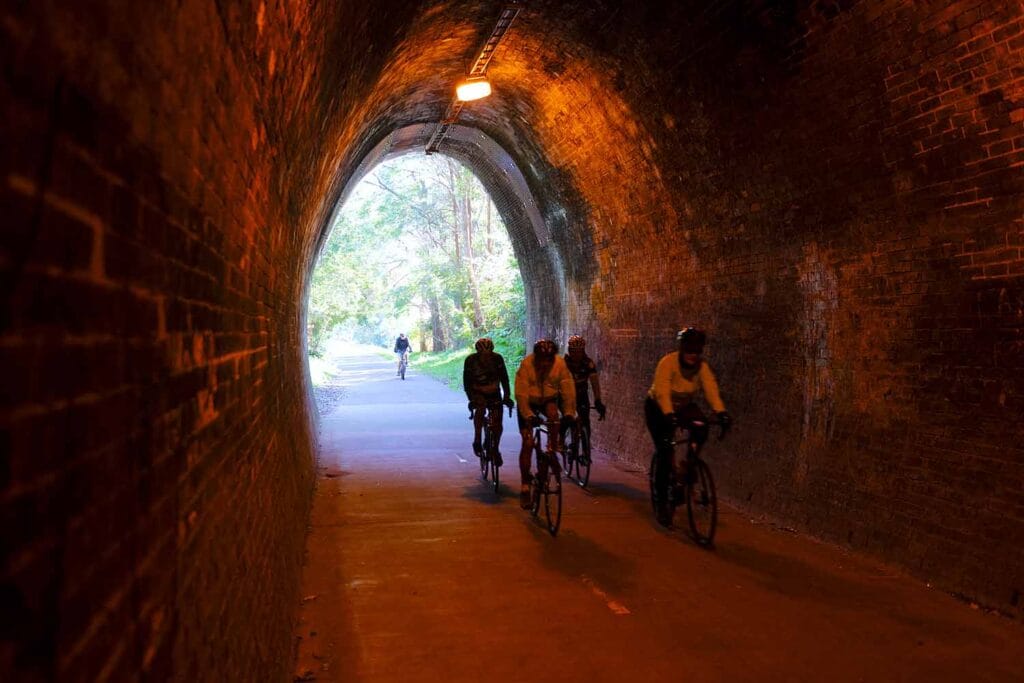


The Fernleigh Track is one of the most popular walking and cycling trails in Lake Macquarie, following the route of the former Belmont railway line for 15 kilometres between Adamstown and Belmont. The fully sealed shared path passes through native bushland, wetlands and peaceful eucalypt forest, with multiple Fernleigh Track entry points making it easy to enjoy a shorter section rather than completing the entire trail.
One of the highlights is the heritage-listed Fernleigh Track Tunnel near Adamstown Heights, which stretches almost 180 metres through solid rock. Continue south and you’ll pass remnants of the original railway corridor, restored bridges and abundant birdlife before eventually reaching Belmont. The relatively gentle gradient and sealed surface make the track suitable for families, walkers, runners and cyclists of varying abilities.
💡 Local Tip. You don’t need to walk the entire 15 kilometres. For a shorter walk, start at Adamstown and explore the Fernleigh Track Tunnel and surrounding bushland, or choose one of the access points at Whitebridge, Redhead or Belmont.
2. Yuelarbah Walking Track
Explore rainforest, waterfalls and spectacular coastal scenery on one of Glenrock’s most popular bushwalks.
Distance: 6.8 km return | Difficulty: Moderate | Allow: 2–3 hours
Best For: Bushwalking, waterfalls, wildlife, photography and nature | Parking: Yuelarbah Trail Car Park, Burwood Road, Kahibah | Facilities: Car parking, picnic areas and lookouts. No toilets.


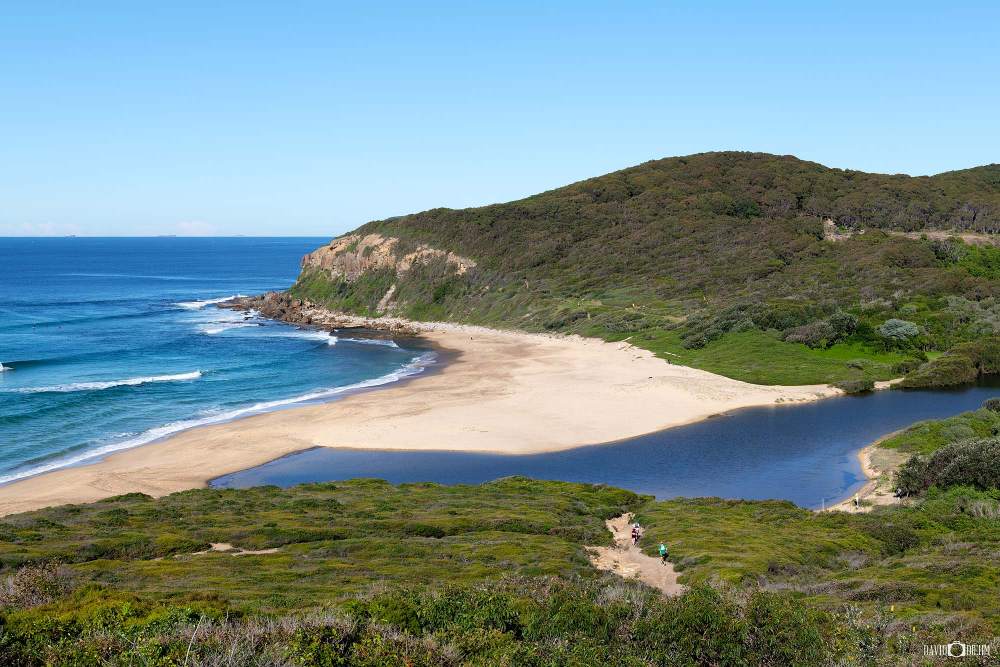
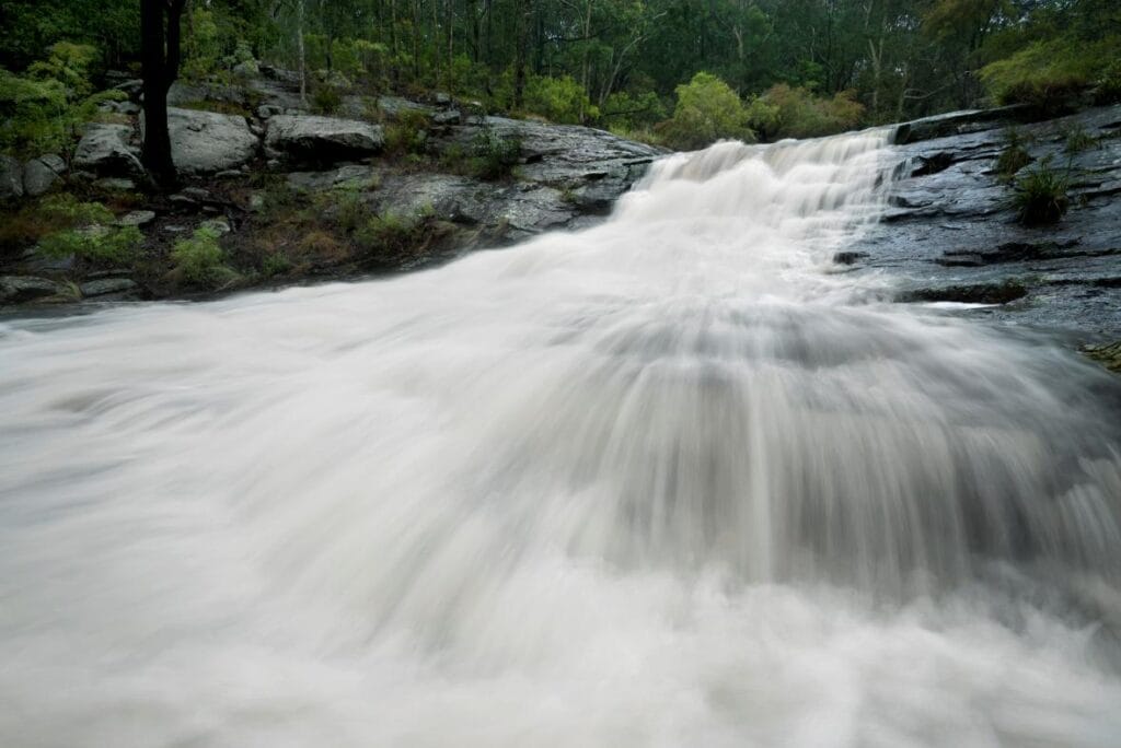
The Yuelarbah Walking Track is one of the most popular Glenrock walks, winding through Glenrock State Conservation Area from the Yuelarbah Trail Car Park on Burwood Road towards Glenrock Lagoon and Burwood Beach. Part of the Great North Walk, the trail descends through towering eucalypt forest and lush rainforest, passing elevated boardwalks, Flaggy Creek, seasonal waterfalls and peaceful creek crossings along the way.
Continue towards the coast and the landscape opens to spectacular views across Glenrock Lagoon, Burwood Beach and the Pacific Ocean, before descending towards Burwood Beach. The return walk includes stairs, creek crossings and moderate climbs, but rewards walkers with an impressive combination of rainforest, wildlife, waterfalls and coastal scenery just minutes from Newcastle.
💡 Local Tip. Visit a day or two after good rainfall when Flaggy Creek and its seasonal waterfalls are at their best. If you have extra time, Glenrock State Conservation Area has an extensive network of side trails to explore around Flaggy Creek, Glenrock Lagoon and the surrounding rainforest.
3. Caves Beach to Pinny Beach Walk
Follow the spectacular Lake Macquarie coastline through Wallarah National Park from the famous Caves Beach sea caves to secluded Pinny Beach.
Distance: 5 km return | Difficulty: Moderate | Allow: 2–3 hours
Best For: Coastal views, beaches, wildlife, whale watching and photography | Parking: Caves Beach Surf Life Saving Club, Caves Beach car park or Spoon Rocks Road | Facilities: Toilets, picnic areas, cafés and beach access at Caves Beach


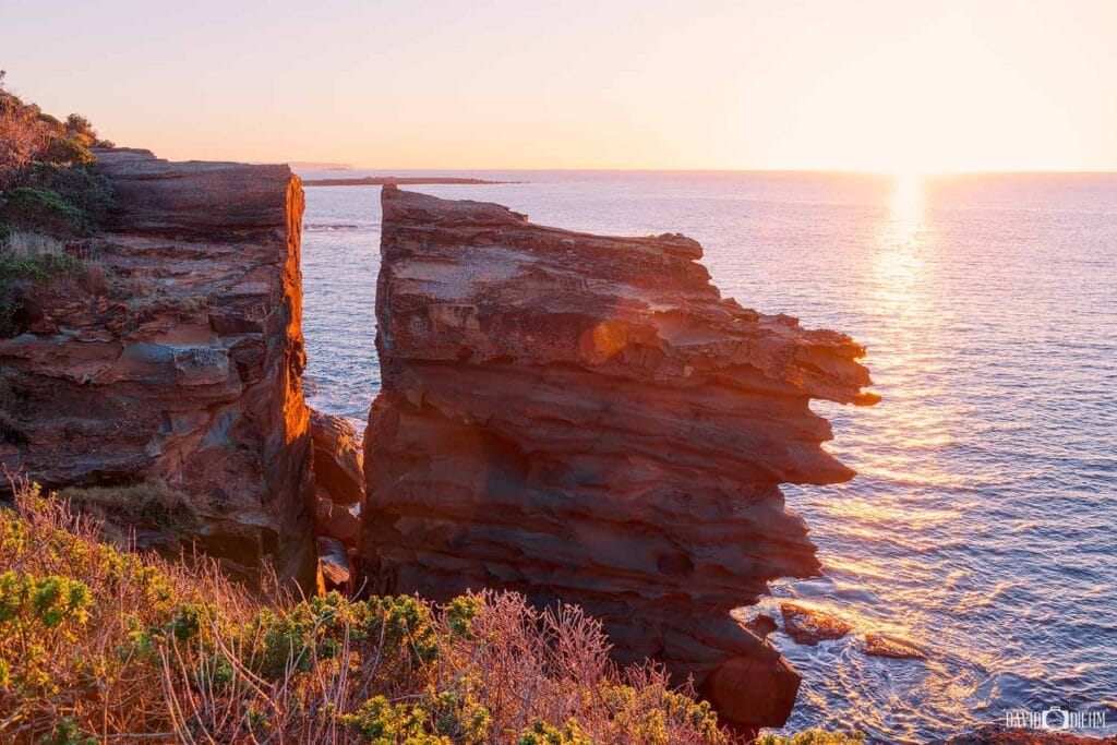

The Caves Beach to Pinny Beach Walk, also known as the Coastal Walking Track, follows the spectacular coastline of Wallarah National Park through coastal heath, native bushland and rugged sandstone headlands. Beginning near Caves Beach, the trail heads south towards secluded Pinny Beach, with sweeping ocean views and opportunities to spot migrating humpback whales between May and November.
Before setting off, allow time to explore the famous Caves Beach sea caves at low tide. Along the walk, highlights include Split Rock, Spoon Rocks Beach and the remote sands of Pinny Beach, creating an impressive mix of sea caves, sandstone cliffs, secluded beaches and pristine coastal bushland. For a shorter option, access the track from Spoon Rocks Road and explore only the southern section towards Split Rock and Pinny Beach.
💡 Local Tip. Time your visit around low tide so you can explore the Caves Beach sea caves before starting the walk. For a shorter option, start from Spoon Rocks Road and walk towards Split Rock or Pinny Beach. Between May and November, keep an eye on the ocean from the elevated headlands for migrating humpback whales.
4. Catherine Hill Bay Rock Pools Walk
Follow the rugged Catherine Hill Bay coastline to hidden turquoise rock pools beneath towering sandstone cliffs.
Distance: 3 km return | Difficulty: Difficult | Allow: 1.5–2.5 hours
Best For: Rock pools, bushwalking, coastal scenery, swimming and adventure | Parking: Catherine Hill Bay Beach Car Park or Northwood Road for a shorter walk | Facilities: Toilets and picnic facilities near Catherine Hill Bay Surf Club


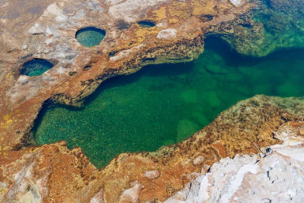
The Catherine Hill Bay Rock Pools Walk is a rugged coastal adventure leading to one of Lake Macquarie’s most spectacular natural swimming spots. Starting near historic Catherine Hill Bay Beach, the route follows the coastline through native bushland and coastal heath, with sandstone cliffs, secluded coves and sweeping Pacific Ocean views along the way.
The highlight is the Catherine Hill Bay rock pools, hidden beneath the cliffs and surrounded by exposed sandstone platforms. On calm days, the clear turquoise pools provide a beautiful place to swim, snorkel and explore marine life, while the elevated coastline offers excellent whale watching between May and November. The track is uneven and poorly formed in sections, so this walk is better suited to confident walkers comfortable with rough coastal terrain.
💡 Local Tip. Visit on a calm day around low tide, when conditions around the rock platforms are generally safest and the pools are easier to explore. Bring sturdy footwear and snorkelling gear, and check the tide and swell before setting out.
5. Warners Bay to Speers Point Walk
Follow the Lake Macquarie shoreline along a scenic shared pathway connecting Warners Bay Foreshore with Speers Point Park.
Distance: 5.6 km one-way | Difficulty: Easy | Allow: 1.5–2.5 hours
Best For: Lakeside scenery, families, cycling, sunsets and accessible walking | Parking: Eleebana Boat Ramp, Warners Bay Foreshore and Speers Point Park | Facilities: Toilets, cafés, playgrounds, picnic areas, fitness stations and shared pathways
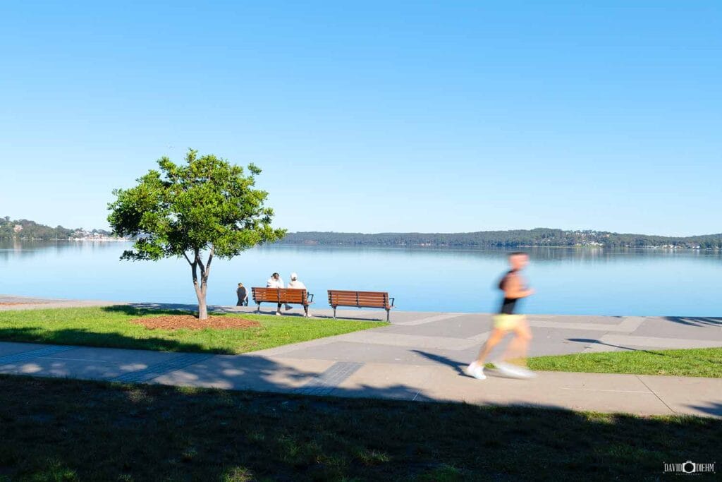
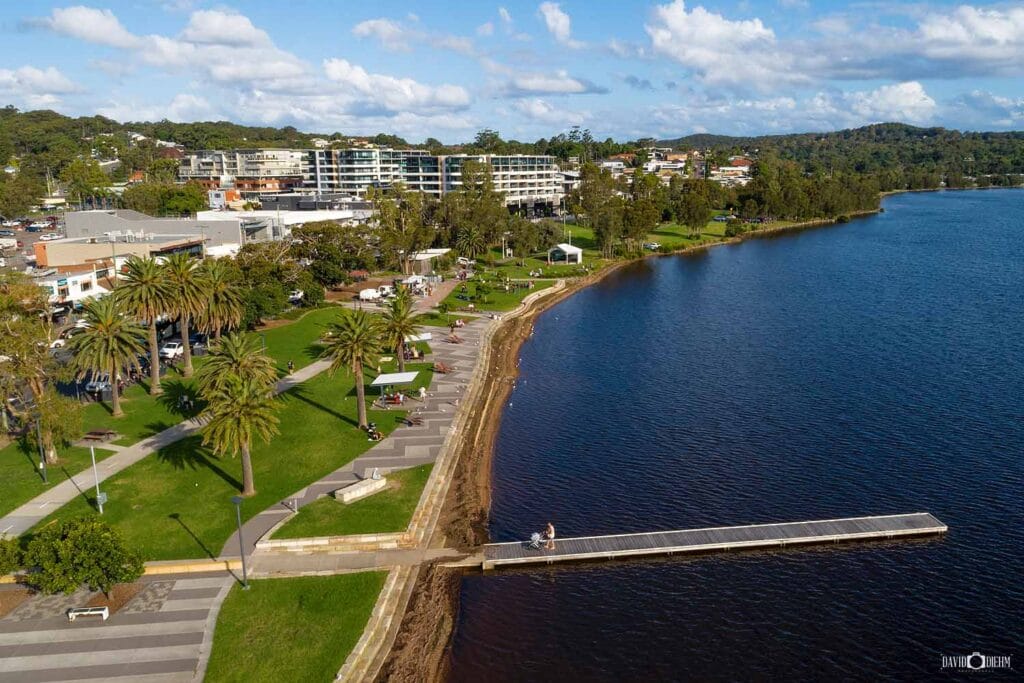
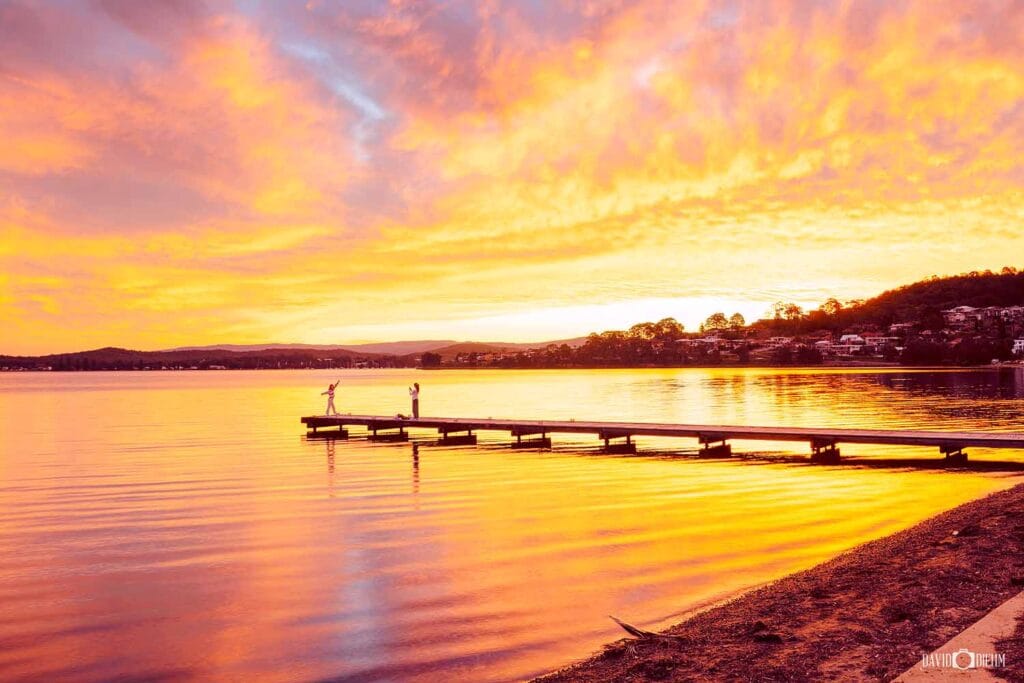
The Warners Bay to Speers Point Walk is one of the most popular foreshore walks in Lake Macquarie, following the lake’s edge between Warners Bay and Speers Point Park. The mostly flat, sealed shared pathway offers beautiful water views along with waterfront parklands, public art, picnic areas and plenty of places to stop for a coffee or simply enjoy the scenery.
Suitable for walkers, runners, cyclists and families with prams, the route passes through Warners Bay Foreshore before continuing towards Speers Point Park, home to extensive parklands, picnic and BBQ facilities and one of the region’s largest playgrounds. With easy terrain and almost continuous views across Lake Macquarie, it’s an excellent choice for a relaxed morning walk, family outing or sunset stroll.
💡 Local Tip. Late afternoon is one of the best times to walk the Warners Bay foreshore, particularly when the lake is calm and the setting sun reflects across the water. Finish at Speers Point Park, where you can extend your visit with a picnic, playground stop or one of the markets and community events regularly held around the park.
6. Green Point Foreshore Walk
Explore peaceful bushland, lakeside boardwalks and panoramic lookouts within Green Point Reserve.
Distance: 7.7 km circuit | Difficulty: Easy | Allow: 2–3 hours
Best For: Lake views, sunsets, wildlife, families and photography | Parking: Green Point Reserve, Shores Way, Belmont | Facilities: Toilets, picnic areas, playgrounds, barbecues and lakeside seating

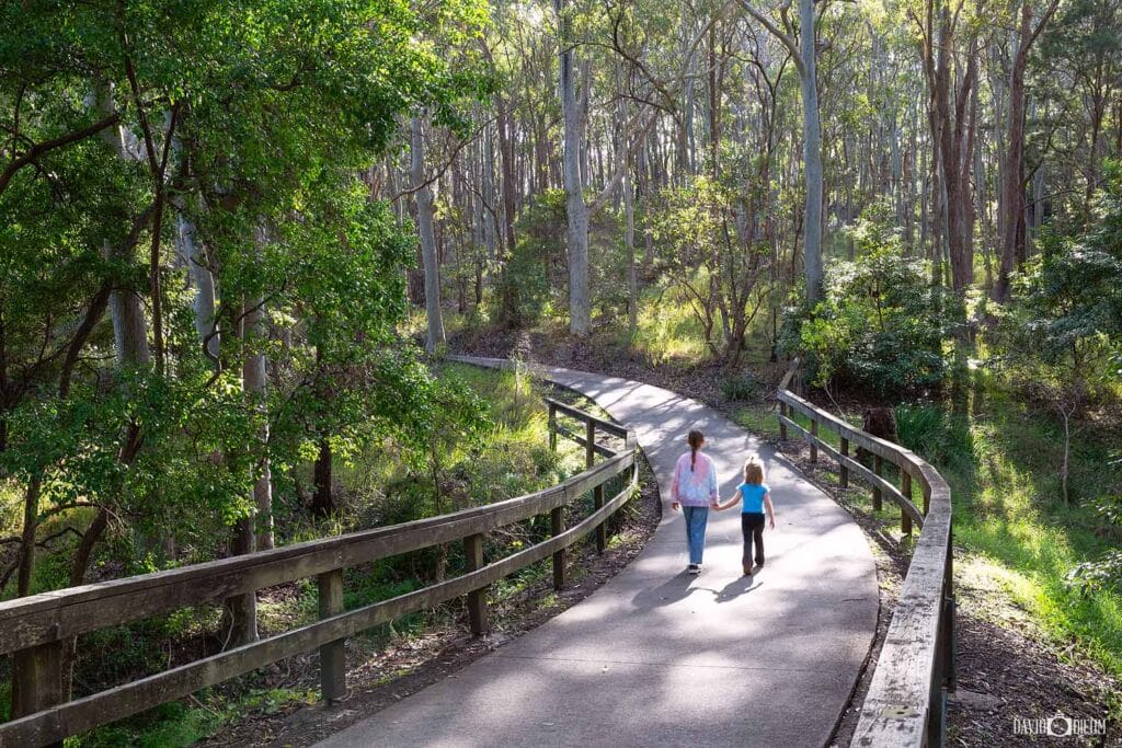
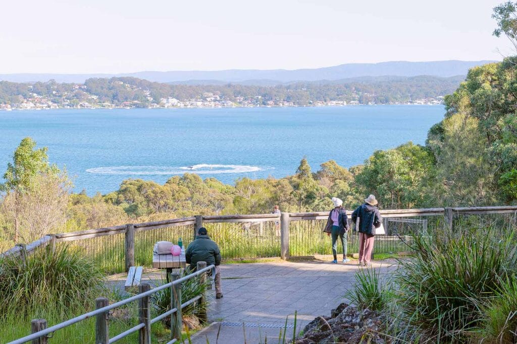
The Green Point Foreshore Walk winds through Green Point Reserve near Belmont, combining native bushland, wetlands and peaceful foreshore trails with beautiful views across Lake Macquarie. The network of shared pathways and boardwalks passes through towering eucalypt forest and sheltered bays before emerging onto open waterfront reserves, with plenty of places to stop and enjoy the lake along the way.
One of the highlights is Sea Eagle Lookout, where tiered viewing platforms provide panoramic views across Lake Macquarie and an excellent vantage point for spotting the White-bellied Sea-Eagles regularly seen around the reserve. Continue towards the foreshore to discover the large lakeside jetty, picnic areas and peaceful waterfront, while those completing the full circuit will encounter a few steeper sections as the trail climbs through the surrounding bushland.
💡 Local Tip. Keep an eye out for White-bellied Sea-Eagles soaring above the lake, particularly around Sea Eagle Lookout. On a warm day, extend your visit to nearby Belmont Baths for a swim after completing the walk.
7. Mount Sugarloaf Walking Track
Climb to the summit of Mount Sugarloaf for panoramic views across Lake Macquarie, Newcastle and the Hunter Region.
Distance: 1 km return | Difficulty: Moderate | Allow: 30–45 minutes
Best For: Short walks, panoramic views, families, sunrise, sunset and photography | Parking: Mount Sugarloaf Summit Car Park | Facilities: Toilets, picnic tables, BBQs, lookout and accessible picnic area

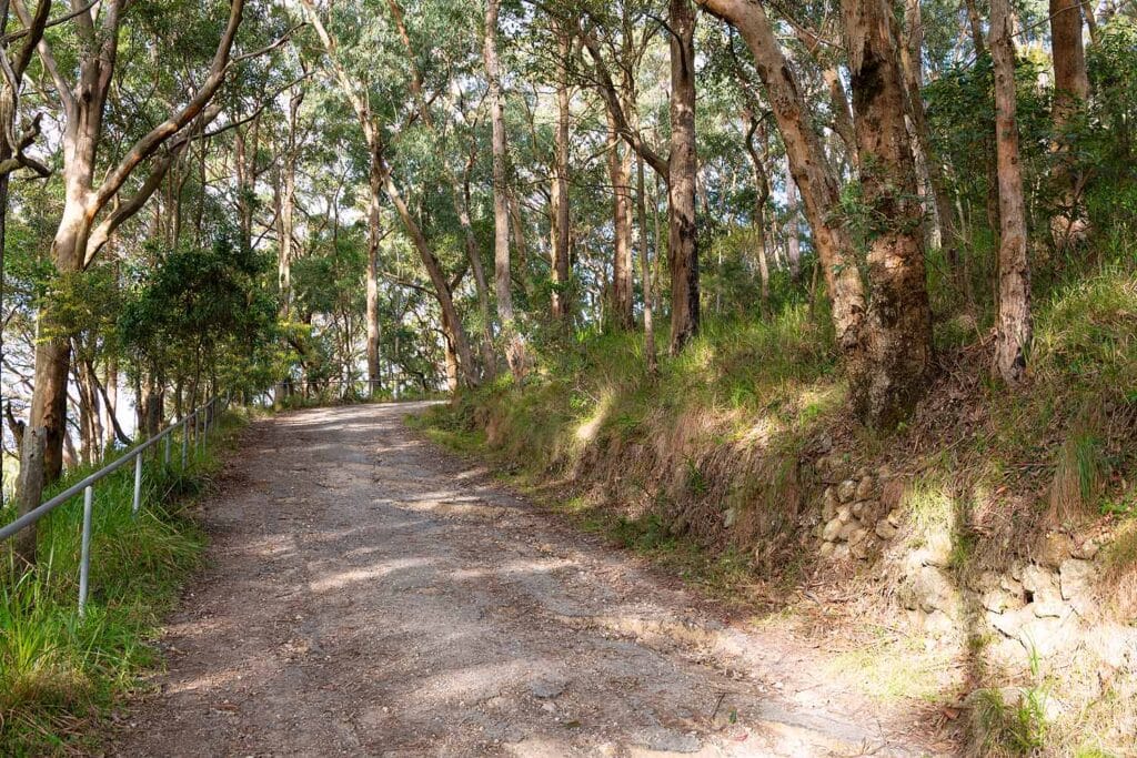
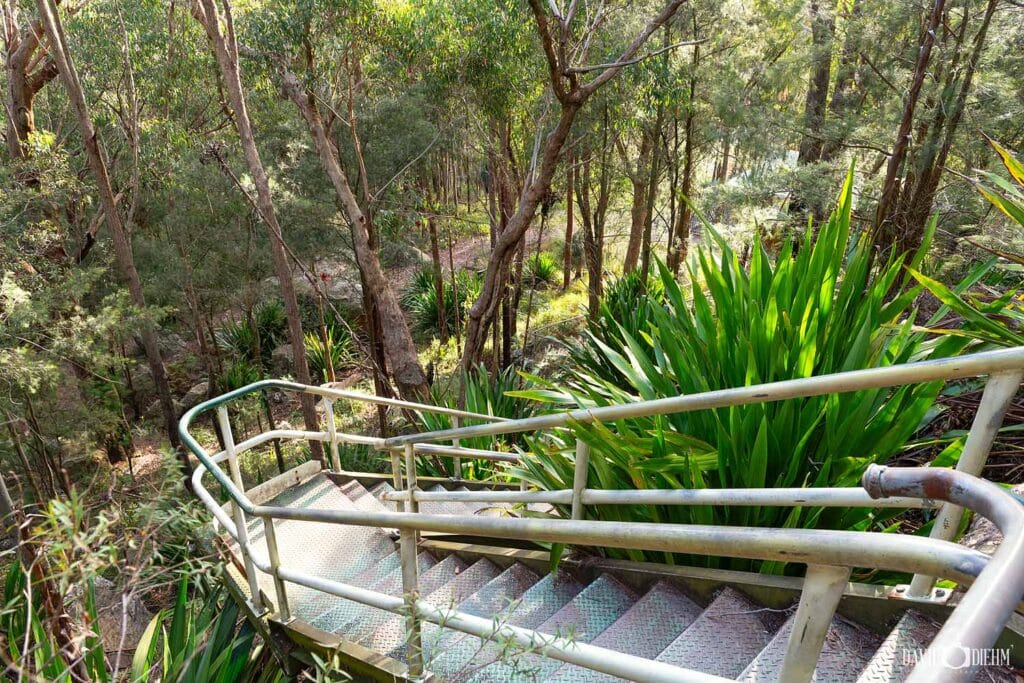
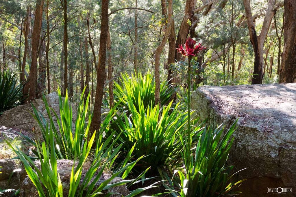
The Mount Sugarloaf Walking Track is a short but steep summit walk within Sugarloaf State Conservation Area, rising to 412 metres above sea level. Beginning from the Mount Sugarloaf Summit Car Park, the track climbs through native eucalypt bushland via natural rock steps and steel staircases to panoramic views across Lake Macquarie, Newcastle, the Hunter Valley and the Watagan Mountains.
Although the climb is short, the uneven steps and steep sections make it more challenging than the distance suggests. The surrounding picnic area has toilets, tables and BBQ facilities, while walkers wanting to explore further can connect with longer bushwalking trails through Sugarloaf State Conservation Area. The elevated summit is particularly rewarding around sunrise and sunset, when changing light can produce spectacular views across the region.
💡 Local Tip. Visit shortly after sunrise for beautiful morning light and the chance of low-lying mist across Lake Macquarie and the Hunter Region. Pack a picnic to enjoy in the grassy area near the car park after completing the summit walk.
8. Nine Mile Beach Walk
Walk the sweeping sands of Nine Mile Beach between Redhead and Blacksmiths along one of Lake Macquarie’s longest stretches of coastline.
Distance: 10.4 km one-way | Difficulty: Moderate | Allow: 3–4 hours
Best For: Beach walking, surfing, fishing, coastal scenery and photography | Parking: Redhead Beach and Blacksmiths Beach car parks | Facilities: Toilets, picnic areas, playgrounds, cafés and patrolled swimming areas at Redhead and Blacksmiths
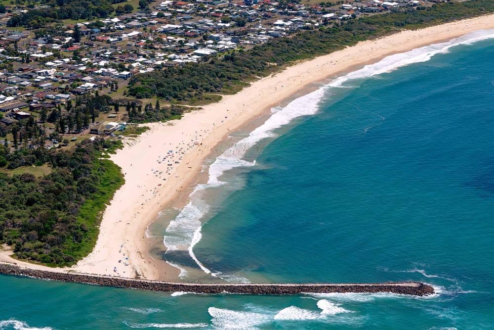


The Nine Mile Beach Walk follows 10.4 kilometres of uninterrupted coastline between Redhead Beach and Blacksmiths Beach. Completed almost entirely along the sand, the walk passes rolling surf, towering coastal dunes and Belmont Wetlands State Park, creating a surprisingly remote coastal experience despite being only a short drive from Newcastle.
At the northern end, Redhead Bluff and the historic Redhead Shark Tower provide a dramatic backdrop, while the southern end reaches Blacksmiths Beach and the entrance to Swansea Channel. The distance, soft sand and exposure can make the full walk challenging, but shorter walks from either end provide an easy way to experience some of the best scenery along Nine Mile Beach without completing the entire 10.4 kilometres.
💡 Local Tip. If you don’t want to tackle the full 10.4 kilometres, explore Nine Mile Beach from either end. At Redhead, visit Redhead Bluff and the historic Shark Tower; at Blacksmiths, continue to the Swansea Channel Breakwall for beautiful coastal views and watch boats travelling between Lake Macquarie and the Pacific Ocean.
9. Red Bluff Boardwalk
Walk above the waters of Lake Macquarie on this accessible foreshore boardwalk at Eleebana.
Distance: 380 m boardwalk | Difficulty: Easy | Allow: 10–20 minutes
Best For: Lake views, sunsets, accessibility, families and photography | Parking: Eleebana Public Car Park, The Esplanade | Facilities: Seating, viewing platforms, picnic areas and nearby foreshore reserves
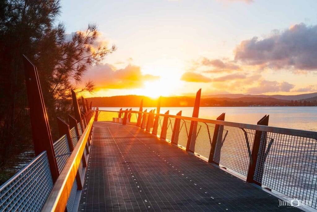


The Red Bluff Boardwalk at Eleebana stretches approximately 380 metres along the Lake Macquarie shoreline, including sections elevated above the water. The wide, mostly flat pathway offers beautiful lake views and is suitable for families, prams, wheelchairs and cyclists, making it one of the most accessible short walks around Lake Macquarie.
Several viewing platforms provide places to stop and enjoy views across the lake towards Warners Bay and Speers Point, while pelicans, black swans and other waterbirds are regularly seen along the shoreline. For a longer walk, the boardwalk connects with the Booragul to Eleebana Shared Pathway, allowing you to continue along the Lake Macquarie foreshore rather than turning around at the end of the boardwalk.
💡 Local Tip. Visit Red Bluff Boardwalk around sunset, when calm conditions can create beautiful reflections across Lake Macquarie. If the 380-metre boardwalk is too short, continue along the connected shared pathway for a longer lakeside walk.
10. Awabakal Coastal Walk (Wildflower Walk).
Walk through colourful coastal heath to spectacular clifftop views across the Pacific Ocean from Awabakal Nature Reserve.
Distance: 1.5 km return | Difficulty: Easy–Moderate | Allow: 30–60 minutes
Best For: Wildflowers, coastal views, whale watching, nature and bushwalking | Parking: Ocean Street cul-de-sac, Dudley | Facilities: Limited facilities. Bring water and sun protection.
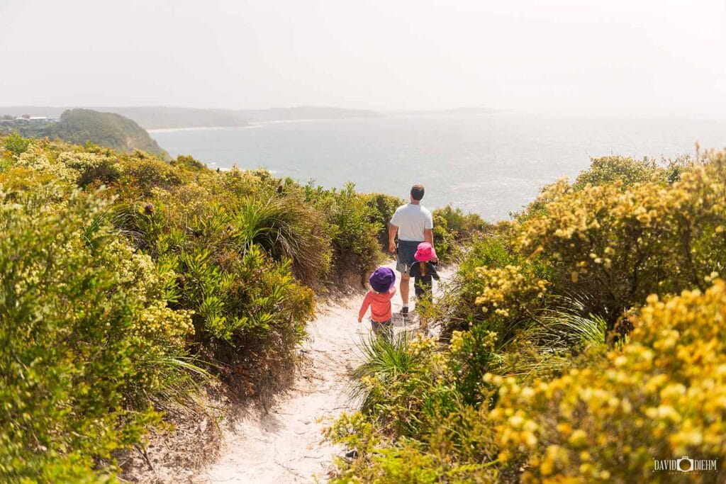


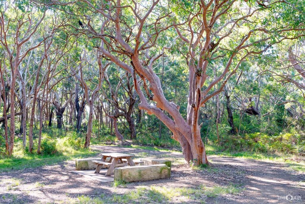
The Awabakal Coastal Walk, also known as the Wildflower Walk, winds through Awabakal Nature Reserve from the end of Ocean Street at Dudley. Sandy tracks cross coastal heath and ancient dune systems before reaching spectacular clifftop views over the Pacific Ocean, with Dudley Bluff Lookout approximately 900 metres from the trailhead.
Between July and October, the reserve comes alive with native wildflowers including Flannel Flowers, Christmas Bells, Banksias, Wattles and native orchids. The elevated coastline is also an excellent place for whale watching between May and November, when migrating humpback whales can often be spotted offshore. With colourful heathland, rugged cliffs and sweeping ocean views, this short walk offers plenty to see without requiring a long hike.
💡 Local Tip. Visit between July and October to see the coastal heath at its most colourful, with native wildflowers blooming throughout Awabakal Nature Reserve. Between May and November, allow some extra time at Dudley Bluff Lookout to watch for migrating humpback whales passing along the coast.
11. Ghosties Beach Walk
Discover secluded beaches, rugged sandstone cliffs and a hidden sea cave along this wild stretch of coastline.
Distance: 4 km return | Difficulty: Moderate | Allow: 1.5–2.5 hours
Best For: Secluded beaches, sea caves, coastal scenery and adventure | Parking: Moonee Beach, Hooey Street, Catherine Hill Bay | Facilities: No facilities. Bring water and suitable footwear.


The Ghosties Beach Walk explores a remote stretch of coastline within Munmorah State Conservation Area, beginning from the Moonee Beach Track before continuing south towards Ghosties Beach. Along the way, walkers pass Moonee Beach, Little Beach and Flat Rocks Point, with golden sandstone cliffs, secluded beaches and untouched coastal bushland creating a genuine sense of remoteness.
The highlight is Ghosties Cave, a remarkable sea cave hidden beneath the sandstone cliffs near the southern end of Ghosties Beach. Best explored around low tide, the cave and nearby rock platforms are surrounded by dramatic coastal scenery, while Flat Rocks Point provides another interesting place to explore along the route. With no facilities or development along the walk, this is one of the more adventurous coastal experiences around Lake Macquarie.
💡 Local Tip. Plan your walk around low tide if you want to explore Ghosties Cave and the surrounding rock platforms. Check the tide and ocean conditions before setting out, wear sturdy footwear and allow extra time to explore Flat Rocks Point and the secluded beaches along the way.
12. Boarding House Dam Walk
Explore lush rainforest, tranquil waterways and the famous moss wall on this short circuit through the Watagans.
Distance: 700 m circuit | Difficulty: Easy | Allow: 20–45 minutes
Best For: Rainforest, families, nature, photography and short walks | Parking: Boarding House Dam Picnic Area, Watagans National Park | Facilities: Toilets, picnic tables, barbecues and parking


The Boarding House Dam Walk is a short rainforest circuit in Watagans National Park near Cooranbong. The track winds beneath towering trees and giant tree ferns, passing moss-covered logs, peaceful waterways and the historic Boarding House Dam, making it an excellent option for families or anyone wanting to experience the Watagans without committing to a longer bushwalk.
One of the highlights is the distinctive moss wall, a long retaining wall covered in vivid green moss and surrounded by lush rainforest. After rainfall, the forest is particularly beautiful, with flowing creeks, vibrant ferns and moss-covered surfaces bringing the landscape to life. With picnic tables and BBQ facilities beside the walk, Boarding House Dam is also an easy place to combine a short bushwalk with a relaxing picnic in the Watagans.
💡 Local Tip. Visit after recent rainfall when the rainforest and moss wall are at their most vibrant. Pack a picnic and allow some extra time to enjoy the peaceful Boarding House Dam Picnic Area after completing the short circuit.
13. Pirrita Island Walk (formerly Coon Island)
Explore boardwalks, mangroves and tidal wetlands where Lake Macquarie meets Swansea Channel.
Distance: 2.5 km return | Difficulty: Easy | Allow: 45–90 minutes
Best For: Lake views, wildlife, families, wetlands and photography | Parking: Swansea Channel Foreshore, Swansea | Facilities: Toilets, picnic areas, cafés and shops nearby in Swansea


The Pirrita Island Walk, on the island formerly known as Coon Island, explores a peaceful wetland environment beside Swansea Channel. Connected to Swansea by a pedestrian bridge, the walk follows boardwalks and foreshore paths through mangroves and tidal wetlands, with beautiful views across Lake Macquarie, Swansea Channel and the surrounding sand islands.
The landscape changes dramatically with the tide as shallow turquoise water moves across sandbars and mangrove-lined channels. Pelicans, black swans, cormorants and other waterbirds are regularly seen around the island, while boats, kayaks and paddleboarders pass through nearby Swansea Channel. The flat terrain and short distance make this an easy walk for families and casual walkers while offering plenty of opportunities for birdwatching and photography.
💡 Local Tip. Visit around a changing tide to see the landscape at its most dynamic, as sandbars appear and disappear beneath the clear waters around Pirrita Island. Early morning can be particularly beautiful when the water is calm, before enjoying a swim at nearby Swansea Beach Bay.
14. Gap Creek Falls Walk
Descend through lush rainforest to one of the Watagans’ most impressive hidden waterfalls.
Distance: 2 km return | Difficulty: Difficult | Allow: 45–90 minutes
Best For: Waterfalls, bushwalking, rainforest and nature | Parking: Gap Creek Picnic Area, Watagans National Park | Facilities: Limited facilities. Picnic area near the trailhead.
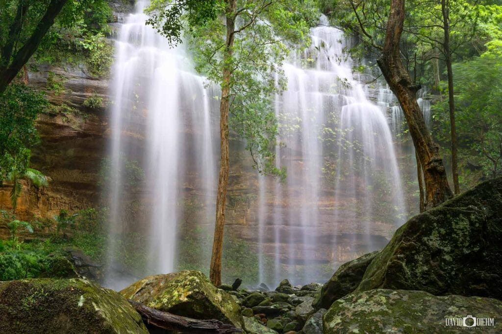

The Gap Creek Falls Walk descends through lush rainforest in Watagans National Park to the secluded Gap Creek Falls. The track winds beneath towering trees and giant tree ferns, passing moss-covered rocks and gullies before reaching a spectacular 40-metre-high rock amphitheatre, where Gap Creek cascades over the sandstone cliff into the rainforest below. During dry periods the waterfall can be little more than a trickle, but after good rainfall it flows strongly and becomes one of the most impressive waterfalls in the Watagans.
Although relatively short, the Gap Creek Falls track is more challenging than the distance suggests, with steep sections, uneven terrain and a demanding climb back to the car park. The surrounding rainforest is particularly beautiful after rain, when the creek is flowing, ferns and mosses become vibrant and the entire gully takes on a lush, almost subtropical appearance.
💡 Local Tip. Visit after recent rainfall when Gap Creek Falls is flowing strongly and the surrounding rainforest is at its most spectacular. Wear sturdy footwear, as the steep track can become muddy and slippery, and be prepared for leeches after wet weather.
15. Cooranbong Swing Bridge Walk
Cross the Sandy Creek Swing Bridge and explore peaceful creekside bushland near Cooranbong.
Distance: 300 m–3 km return | Difficulty: Easy | Allow: 15–90 minutes
Best For: Families, wildlife, creek scenery and easy walking | Parking: Sandy Creek Reserve, Cooranbong | Facilities: Picnic areas, parking and nearby public amenities
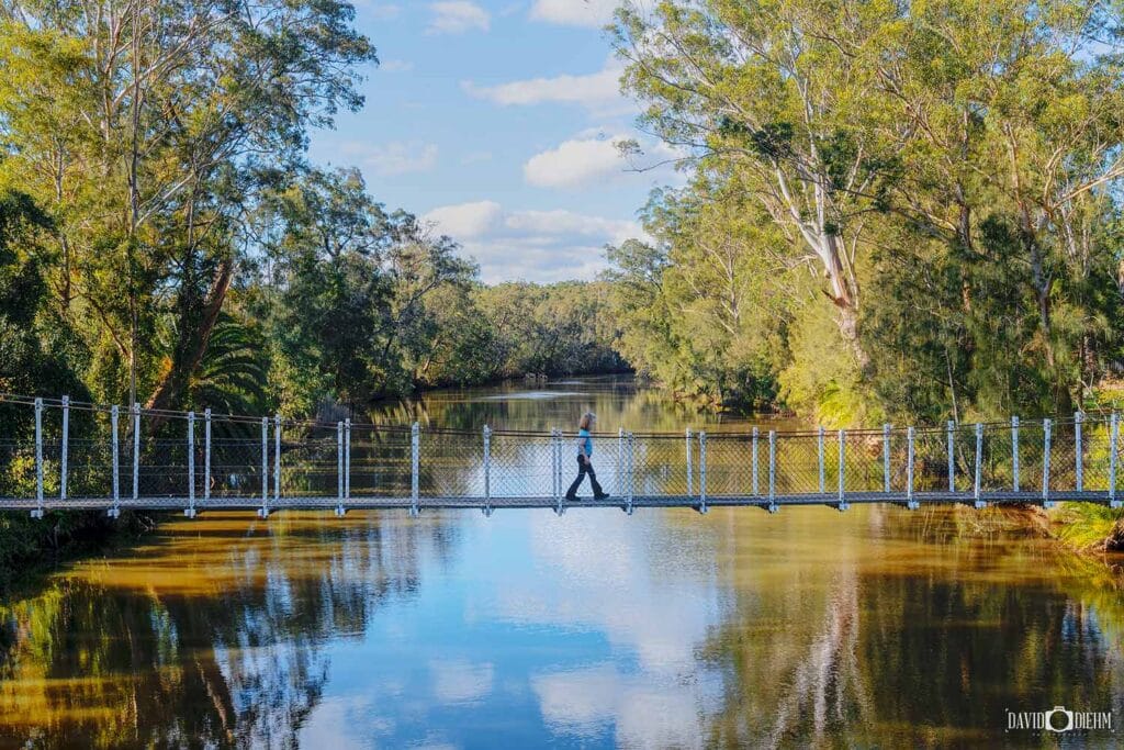


The Cooranbong Swing Bridge Walk is an easy family-friendly walk through Sandy Creek Reserve near Cooranbong. The highlight is the Sandy Creek Swing Bridge, a suspension bridge surrounded by tall eucalypts and peaceful creek scenery. A short walk is all that’s needed to visit the bridge, while the surrounding tracks can be combined for a longer wander through the reserve.
Beyond the bridge, walking trails follow the creek through native bushland and open grassy areas, with turtles, water dragons, kingfishers and other native birdlife often seen around the water. The easy terrain, picnic areas and opportunity to choose anything from a quick bridge visit to a longer walk make this a particularly good option for families with younger children.
💡 Local Tip. If you’re visiting with children, don’t just stop at the swing bridge. Bring a picnic and allow some extra time to explore Sandy Creek Reserve, keeping an eye out for turtles, water dragons and birdlife around the creek.
Distance: 15 km one-way | Difficulty: Easy | Allow: 3–5 hours
Best For: Walking, cycling, families, history and wildlife | Parking: Adamstown, Whitebridge, Redhead and Belmont access points | Facilities: Toilets, picnic areas, water stations and multiple entry points along the route
The Fernleigh Track is one of the most popular walking and cycling trails in Lake Macquarie, following the route of the former Belmont railway line for 15 kilometres between Adamstown and Belmont. The fully sealed shared path passes through native bushland, wetlands and peaceful eucalypt forest, with multiple Fernleigh Track entry points making it easy to enjoy a shorter section rather than completing the entire trail.
One of the highlights is the heritage-listed Fernleigh Track Tunnel near Adamstown Heights, which stretches almost 180 metres through solid rock. Continue south and you’ll pass remnants of the original railway corridor, restored bridges and abundant birdlife before eventually reaching Belmont. The relatively gentle gradient and sealed surface make the track suitable for families, walkers, runners and cyclists of varying abilities.
💡 Local Tip. For a shorter walk, explore the tunnel from Adamstown.
Distance: 6.8 km return | Difficulty: Moderate | Allow: 2–3 hours
Best For: Bushwalking, waterfalls, wildlife, photography and nature | Parking: Yuelarbah Trail Car Park, Burwood Road, Kahibah | Facilities: Car parking, picnic areas and lookouts. No toilets.
The Yuelarbah Walking Track is one of the most popular Glenrock walks, winding through Glenrock State Conservation Area from the Yuelarbah Trail Car Park on Burwood Road towards Glenrock Lagoon and Burwood Beach. Part of the Great North Walk, the trail descends through towering eucalypt forest and lush rainforest, passing elevated boardwalks, Flaggy Creek, seasonal waterfalls and peaceful creek crossings along the way.
Continue towards the coast and the landscape opens to spectacular views across Glenrock Lagoon, Burwood Beach and the Pacific Ocean, before descending towards Burwood Beach. The return walk includes stairs, creek crossings and moderate climbs, but rewards walkers with an impressive combination of rainforest, wildlife, waterfalls and coastal scenery just minutes from Newcastle.
💡 Local Tip. Visit after good rainfall when Flaggy Creek and its waterfalls are at their best. Allow extra time to explore Glenrock’s surrounding trails.
Distance: 5 km return | Difficulty: Moderate | Allow: 2–3 hours
Best For: Coastal views, beaches, wildlife, whale watching and photography | Parking: Caves Beach Surf Life Saving Club, Caves Beach car park or Spoon Rocks Road | Facilities: Toilets, picnic areas, cafés and beach access at Caves Beach
The Caves Beach to Pinny Beach Walk, also known as the Coastal Walking Track, follows the spectacular coastline of Wallarah National Park through coastal heath, native bushland and rugged sandstone headlands. Beginning near Caves Beach, the trail heads south towards secluded Pinny Beach, with sweeping ocean views and opportunities to spot migrating humpback whales between May and November.
Before setting off, allow time to explore the famous Caves Beach sea caves at low tide. Along the walk, highlights include Split Rock, Spoon Rocks Beach and the remote sands of Pinny Beach, creating an impressive mix of sea caves, sandstone cliffs, secluded beaches and pristine coastal bushland. For a shorter option, access the track from Spoon Rocks Road and explore only the southern section towards Split Rock and Pinny Beach.
💡 Local Tip. Visit at low tide to explore the Caves Beach sea caves before your walk. For a shorter option, start at Spoon Rocks Road.
Distance: 3 km return | Difficulty: Difficult | Allow: 1.5–2.5 hours
Best For: Rock pools, bushwalking, coastal scenery, swimming and adventure | Parking: Catherine Hill Bay Beach Car Park or Northwood Road for a shorter walk | Facilities: Toilets and picnic facilities near Catherine Hill Bay Surf Club
The Catherine Hill Bay Rock Pools Walk is a rugged coastal adventure leading to one of Lake Macquarie’s most spectacular natural swimming spots. Starting near historic Catherine Hill Bay Beach, the route follows the coastline through native bushland and coastal heath, with sandstone cliffs, secluded coves and sweeping Pacific Ocean views along the way.
The highlight is the Catherine Hill Bay rock pools, hidden beneath the cliffs and surrounded by exposed sandstone platforms. On calm days, the clear turquoise pools provide a beautiful place to swim, snorkel and explore marine life, while the elevated coastline offers excellent whale watching between May and November. The track is uneven and poorly formed in sections, so this walk is better suited to confident walkers comfortable with rough coastal terrain.
💡 Local Tip. Visit on a calm day around low tide when the rock pools are easiest to explore. Check the tide and swell, and wear sturdy footwear.
Distance: 5.6 km one-way | Difficulty: Easy | Allow: 1.5–2.5 hours
Best For: Lakeside scenery, families, cycling, sunsets and accessible walking | Parking: Eleebana Boat Ramp, Warners Bay Foreshore and Speers Point Park | Facilities: Toilets, cafés, playgrounds, picnic areas, fitness stations and shared pathways
The Warners Bay to Speers Point Walk is one of the most popular foreshore walks in Lake Macquarie, following the lake’s edge between Warners Bay and Speers Point Park. The mostly flat, sealed shared pathway offers beautiful water views along with waterfront parklands, public art, picnic areas and plenty of places to stop for a coffee or simply enjoy the scenery.
Suitable for walkers, runners, cyclists and families with prams, the route passes through Warners Bay Foreshore before continuing towards Speers Point Park, home to extensive parklands, picnic and BBQ facilities and one of the region’s largest playgrounds. With easy terrain and almost continuous views across Lake Macquarie, it’s an excellent choice for a relaxed morning walk, family outing or sunset stroll.
💡 Local Tip. Visit in the late afternoon for beautiful sunset reflections across the lake. Finish at Speers Point Park for a picnic, playground or local event.
Distance: 7.7 km circuit | Difficulty: Easy | Allow: 2–3 hours
Best For: Lake views, sunsets, wildlife, families and photography | Parking: Green Point Reserve, Shores Way, Belmont | Facilities: Toilets, picnic areas, playgrounds, barbecues and lakeside seating
The Green Point Foreshore Walk winds through Green Point Reserve near Belmont, combining native bushland, wetlands and peaceful foreshore trails with beautiful views across Lake Macquarie. The network of shared pathways and boardwalks passes through towering eucalypt forest and sheltered bays before emerging onto open waterfront reserves, with plenty of places to stop and enjoy the lake along the way.
One of the highlights is Sea Eagle Lookout, where tiered viewing platforms provide panoramic views across Lake Macquarie and an excellent vantage point for spotting the White-bellied Sea-Eagles regularly seen around the reserve. Continue towards the foreshore to discover the large lakeside jetty, picnic areas and peaceful waterfront, while those completing the full circuit will encounter a few steeper sections as the trail climbs through the surrounding bushland.
💡 Local Tip. Look for White-bellied Sea-Eagles around Sea Eagle Lookout. On warmer days, finish with a swim at nearby Belmont Baths.
Distance: 1 km return | Difficulty: Moderate | Allow: 30–45 minutes
Best For: Short walks, panoramic views, families, sunrise, sunset and photography | Parking: Mount Sugarloaf Summit Car Park | Facilities: Toilets, picnic tables, BBQs, lookout and accessible picnic area
The Mount Sugarloaf Walking Track is a short but steep summit walk within Sugarloaf State Conservation Area, rising to 412 metres above sea level. Beginning from the Mount Sugarloaf Summit Car Park, the track climbs through native eucalypt bushland via natural rock steps and steel staircases to panoramic views across Lake Macquarie, Newcastle, the Hunter Valley and the Watagan Mountains.
Although the climb is short, the uneven steps and steep sections make it more challenging than the distance suggests. The surrounding picnic area has toilets, tables and BBQ facilities, while walkers wanting to explore further can connect with longer bushwalking trails through Sugarloaf State Conservation Area. The elevated summit is particularly rewarding around sunrise and sunset, when changing light can produce spectacular views across the region.
💡 Local Tip. Visit shortly after sunrise for beautiful light and the chance of low-lying mist. Pack a picnic to enjoy near the summit car park.
Distance: 10.4 km one-way | Difficulty: Moderate | Allow: 3–4 hours
Best For: Beach walking, surfing, fishing, coastal scenery and photography | Parking: Redhead Beach and Blacksmiths Beach car parks | Facilities: Toilets, picnic areas, playgrounds, cafés and patrolled swimming areas at Redhead and Blacksmiths
The Nine Mile Beach Walk follows 10.4 kilometres of uninterrupted coastline between Redhead Beach and Blacksmiths Beach. Completed almost entirely along the sand, the walk passes rolling surf, towering coastal dunes and Belmont Wetlands State Park, creating a surprisingly remote coastal experience despite being only a short drive from Newcastle.
At the northern end, Redhead Bluff and the historic Redhead Shark Tower provide a dramatic backdrop, while the southern end reaches Blacksmiths Beach and the entrance to Swansea Channel. The distance, soft sand and exposure can make the full walk challenging, but shorter walks from either end provide an easy way to experience some of the best scenery along Nine Mile Beach without completing the entire 10.4 kilometres.
💡 Local Tip. For a shorter walk, explore Nine Mile Beach from either end. Visit Redhead Bluff and the Shark Tower, or the Swansea Channel Breakwall at Blacksmiths.
Distance: 380 m boardwalk | Difficulty: Easy | Allow: 10–20 minutes
Best For: Lake views, sunsets, accessibility, families and photography | Parking: Eleebana Public Car Park, The Esplanade | Facilities: Seating, viewing platforms, picnic areas and nearby foreshore reserves
The Red Bluff Boardwalk at Eleebana stretches approximately 380 metres along the Lake Macquarie shoreline, including sections elevated above the water. The wide, mostly flat pathway offers beautiful lake views and is suitable for families, prams, wheelchairs and cyclists, making it one of the most accessible short walks around Lake Macquarie.
Several viewing platforms provide places to stop and enjoy views across the lake towards Warners Bay and Speers Point, while pelicans, black swans and other waterbirds are regularly seen along the shoreline. For a longer walk, the boardwalk connects with the Booragul to Eleebana Shared Pathway, allowing you to continue along the Lake Macquarie foreshore rather than turning around at the end of the boardwalk.
💡 Local Tip. Visit around sunset for beautiful reflections across Lake Macquarie.
Distance: 1.5 km return | Difficulty: Easy–Moderate | Allow: 30–60 minutes
Best For: Wildflowers, coastal views, whale watching, nature and bushwalking | Parking: Ocean Street cul-de-sac, Dudley | Facilities: Limited facilities. Bring water and sun protection.
The Awabakal Coastal Walk, also known as the Wildflower Walk, winds through Awabakal Nature Reserve from the end of Ocean Street at Dudley. Sandy tracks cross coastal heath and ancient dune systems before reaching spectacular clifftop views over the Pacific Ocean, with Dudley Bluff Lookout approximately 900 metres from the trailhead.
Between July and October, the reserve comes alive with native wildflowers including Flannel Flowers, Christmas Bells, Banksias, Wattles and native orchids. The elevated coastline is also an excellent place for whale watching between May and November, when migrating humpback whales can often be spotted offshore. With colourful heathland, rugged cliffs and sweeping ocean views, this short walk offers plenty to see without requiring a long hike.
💡 Local Tip. Visit from July to October for colourful native wildflowers. From May to November, watch for migrating whales from Dudley Bluff Lookout.
Distance: 4 km return | Difficulty: Moderate | Allow: 1.5–2.5 hours
Best For: Secluded beaches, sea caves, coastal scenery and adventure | Parking: Moonee Beach, Hooey Street, Catherine Hill Bay | Facilities: No facilities. Bring water and suitable footwear.
The Ghosties Beach Walk explores a remote stretch of coastline within Munmorah State Conservation Area, beginning from the Moonee Beach Track before continuing south towards Ghosties Beach. Along the way, walkers pass Moonee Beach, Little Beach and Flat Rocks Point, with golden sandstone cliffs, secluded beaches and untouched coastal bushland creating a genuine sense of remoteness.
The highlight is Ghosties Cave, a remarkable sea cave hidden beneath the sandstone cliffs near the southern end of Ghosties Beach. Best explored around low tide, the cave and nearby rock platforms are surrounded by dramatic coastal scenery, while Flat Rocks Point provides another interesting place to explore along the route. With no facilities or development along the walk, this is one of the more adventurous coastal experiences around Lake Macquarie.
💡 Local Tip. Visit around low tide to explore Ghosties Cave and the rock platforms. Check ocean conditions and wear sturdy footwear.
Distance: 700 m circuit | Difficulty: Easy | Allow: 20–45 minutes
Best For: Rainforest, families, nature, photography and short walks | Parking: Boarding House Dam Picnic Area, Watagans National Park | Facilities: Toilets, picnic tables, barbecues and parking
The Boarding House Dam Walk is a short rainforest circuit in Watagans National Park near Cooranbong. The track winds beneath towering trees and giant tree ferns, passing moss-covered logs, peaceful waterways and the historic Boarding House Dam, making it an excellent option for families or anyone wanting to experience the Watagans without committing to a longer bushwalk.
One of the highlights is the distinctive moss wall, a long retaining wall covered in vivid green moss and surrounded by lush rainforest. After rainfall, the forest is particularly beautiful, with flowing creeks, vibrant ferns and moss-covered surfaces bringing the landscape to life. With picnic tables and BBQ facilities beside the walk, Boarding House Dam is also an easy place to combine a short bushwalk with a relaxing picnic in the Watagans.
💡 Local Tip. Visit after recent rainfall when the rainforest and moss wall are at their best. Pack a picnic to enjoy at Boarding House Dam.
Distance: 2.5 km return | Difficulty: Easy | Allow: 45–90 minutes
Best For: Lake views, wildlife, families, wetlands and photography | Parking: Swansea Channel Foreshore, Swansea | Facilities: Toilets, picnic areas, cafés and shops nearby in Swansea
The Pirrita Island Walk, on the island formerly known as Coon Island, explores a peaceful wetland environment beside Swansea Channel. Connected to Swansea by a pedestrian bridge, the walk follows boardwalks and foreshore paths through mangroves and tidal wetlands, with beautiful views across Lake Macquarie, Swansea Channel and the surrounding sand islands.
The landscape changes dramatically with the tide as shallow turquoise water moves across sandbars and mangrove-lined channels. Pelicans, black swans, cormorants and other waterbirds are regularly seen around the island, while boats, kayaks and paddleboarders pass through nearby Swansea Channel. The flat terrain and short distance make this an easy walk for families and casual walkers while offering plenty of opportunities for birdwatching and photography.
💡 Local Tip. Visit around a changing tide to see the shifting sandbars around Pirrita Island. Afterwards, enjoy a swim at nearby Swansea Beach Bay.
Distance: 2 km return | Difficulty: Difficult | Allow: 45–90 minutes
Best For: Waterfalls, bushwalking, rainforest and nature | Parking: Gap Creek Picnic Area, Watagans National Park | Facilities: Limited facilities. Picnic area near the trailhead.
The Gap Creek Falls Walk descends through lush rainforest in Watagans National Park to the secluded Gap Creek Falls. The track winds beneath towering trees and giant tree ferns, passing moss-covered rocks and gullies before reaching a spectacular 40-metre-high rock amphitheatre, where Gap Creek cascades over the sandstone cliff into the rainforest below. During dry periods the waterfall can be little more than a trickle, but after good rainfall it flows strongly and becomes one of the most impressive waterfalls in the Watagans.
Although relatively short, the Gap Creek Falls track is more challenging than the distance suggests, with steep sections, uneven terrain and a demanding climb back to the car park. The surrounding rainforest is particularly beautiful after rain, when the creek is flowing, ferns and mosses become vibrant and the entire gully takes on a lush, almost subtropical appearance.
💡 Local Tip. Visit after recent rainfall when Gap Creek Falls is flowing strongly. Wear sturdy footwear and be prepared for slippery tracks and leeches.
Distance: 300 m–3 km return | Difficulty: Easy | Allow: 15–90 minutes
Best For: Families, wildlife, creek scenery and easy walking | Parking: Sandy Creek Reserve, Cooranbong | Facilities: Picnic areas, parking and nearby public amenities
The Cooranbong Swing Bridge Walk is an easy family-friendly walk through Sandy Creek Reserve near Cooranbong. The highlight is the Sandy Creek Swing Bridge, a suspension bridge surrounded by tall eucalypts and peaceful creek scenery. A short walk is all that’s needed to visit the bridge, while the surrounding tracks can be combined for a longer wander through the reserve.
Beyond the bridge, walking trails follow the creek through native bushland and open grassy areas, with turtles, water dragons, kingfishers and other native birdlife often seen around the water. The easy terrain, picnic areas and opportunity to choose anything from a quick bridge visit to a longer walk make this a particularly good option for families with younger children.
💡 Local Tip. Bring a picnic and explore beyond the swing bridge. Keep an eye out for turtles, water dragons and birdlife around Sandy Creek Reserve.
Explore Lake Macquarie on Foot
From the Fernleigh Track and Yuelarbah Walking Track to hidden waterfalls, peaceful lakeside paths and rugged coastal trails, the best walks in Lake Macquarie reveal just how diverse this region really is. Within a relatively short distance, you can wander through rainforest, explore secluded beaches, discover natural rock pools or simply follow the shoreline with beautiful views across the lake.
After more than 20 years living in the region and over a decade exploring and photographing its landscapes, I’ve found that some of Lake Macquarie’s most memorable places are best discovered on foot. Whether it’s the turquoise waters around Catherine Hill Bay, wildflowers in Awabakal Nature Reserve, the rainforest surrounding Gap Creek Falls or a quiet morning beside the lake, there is always somewhere new to explore.
Whether you’re looking for a short family walk, a weekend bushwalk or your next coastal adventure, I hope this guide helps you discover a new corner of Lake Macquarie.
Explore More of Lake Macquarie
Planning your next adventure? Discover more of Lake Macquarie, Newcastle and Port Stephens with my local guides to the region’s best beaches, things to do, coastal lookouts and places to explore.
Keep exploring with these local guides:
Newcastle
Best Lookouts in Newcastle NSW
Lake Macquarie
Things to Do in Lake Macquarie
Best Beaches in Lake Macquarie
Port Stephens
Frequently Asked Questions About the Best Walks in Lake Macquarie
What are the best walks in Lake Macquarie?
The best walks in Lake Macquarie include Fernleigh Track, Yuelarbah Walking Track, Warners Bay to Speers Point Walk, Caves Beach to Pinny Beach Walk and Green Point Foreshore Walk. These trails showcase the region’s diverse landscapes, including bushland, beaches, rainforest and lakeside scenery.
What is the most popular walk in Lake Macquarie?
Fernleigh Track is the most popular walk in Lake Macquarie. The 15-kilometre rail trail connects Adamstown and Belmont, passing through bushland, wetlands and the historic Fernleigh Tunnel, making it a favourite among walkers, runners and cyclists.
What is the best bushwalk in Lake Macquarie?
Yuelarbah Walking Track is one of the best bushwalks in Lake Macquarie. Located within Glenrock State Conservation Area, it passes through rainforest, waterfalls, native bushland and scenic lookouts overlooking Glenrock Lagoon and Beach.
What is the easiest walk in Lake Macquarie?
The Warners Bay to Speers Point Walk is one of the easiest walks in Lake Macquarie. The flat foreshore pathway follows the lake’s edge and is suitable for families, prams, cyclists and visitors of all ages.
Where can I see wildflowers in Lake Macquarie?
The Awabakal Coastal Wildflower Walk at Dudley is one of the best places to see wildflowers in Lake Macquarie. Native heathland bursts into colour between July and October, with Flannel Flowers, Christmas Bells, Banksias and native orchids commonly seen.
What is the best waterfall walk in Lake Macquarie?
Gap Creek Falls Walk is one of the best waterfall walks in Lake Macquarie. The trail descends through rainforest to a spectacular 40-metre waterfall that cascades into a natural amphitheatre within the Watagans.
What is the best beach walk in Lake Macquarie?
Nine Mile Beach Walk is one of the best beach walks in Lake Macquarie. Stretching approximately 10 kilometres between Redhead and Blacksmiths, it offers expansive ocean views, wildlife spotting and one of the longest uninterrupted beaches in New South Wales.
Are there family-friendly walks in Lake Macquarie?
Yes. Green Point Foreshore Walk, Warners Bay to Speers Point Walk and Cooranbong Swing Bridge Walk are among the most family-friendly walks in Lake Macquarie thanks to their easy terrain, facilities and scenic surroundings.
What are the best free things to do in Lake Macquarie?
Walking is one of the best free activities in Lake Macquarie. Popular options include Fernleigh Track, Green Point Foreshore Walk, Warners Bay Foreshore Walk and Nine Mile Beach Walk, all of which showcase the region’s natural beauty without any entry fees.
Are there any rainforest walks in Lake Macquarie?
Yes. Boarding House Dam Walk and Gap Creek Falls Walk are two of the best rainforest walks in Lake Macquarie, featuring towering ferns, moss-covered forest and beautiful natural scenery within the Watagans.
Where can I see whales in Lake Macquarie?
Some of the best whale-watching locations in Lake Macquarie include the Awabakal Coastal Wildflower Walk, Caves Beach to Pinny Beach Walk and Ken & Audrey Owens Walk at Redhead. Humpback whales are commonly seen between May and November.